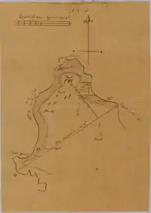
Rancho Punta de Pinos
Rancho Punta de los Piños was a 2,667-acre (10.79 km2) Mexican land grant in present day Monterey County, California given in 1833 by Governor José Figueroa to José María Armenta, and regranted to José Abrego in 1844 by Governor Manuel Micheltorena.[1] The name means "Point of the Pines". The grant extended along the Pacific coast from Point Piños near Pacific Grove south to Rancho Pescadero.[2][3]

History
José María Armenta, was born in Mexico in 1761 and was granted the half square league Rancho Punta de Piños in 1833. In 1844 the land was regranted to José Abrego by Governor Manuel Micheltorena. José Abrego (1803–1878) came to California in 1834 with the Hijar-Padres Colony. In 1836, Abrego married Maria Josefa Estrada (1814–1897), daughter of José Raimundo Estrada (1784–) and half sister of Juan B. Alvarado. José Abrego was administrator of Mission San Antonio in 1833 and 1834, customs officer, member of the Assembly. In 1841 under somewhat mysterious circumstances his wife Maria Josefa Abrego bought Rancho San Jose y Sur Chiquito. José Abrego bought Rancho San Francisquito in 1853.
José Abrego sold Rancho Punta de Piños to Thomas O Larkin and three other associates (Jacob P. Leese, Milton Little, and James H. Gleason) in 1850. By the time of the patent, county sheriff Henry DeGraw had acquired the share of Leese; and Charles Brown had acquired the share of Gleason.[4]
With the cession of California to the United States following the Mexican-American War, the 1848 Treaty of Guadalupe Hidalgo provided that the land grants would be honored. As required by the Land Act of 1851, a claim for Rancho Punta de Piños was filed by Leese, Little, and Gleason with the Public Land Commission in 1852,[5] and the grant was patented to Henry DeGraw and Charles Brown in 1880.[6] A claim filed by L. E. Pogue and Pacificus Ord with the Land Commission in 1853 was rejected.[7]
In 1850, the United States Congress appropriated money to build lighthouses on the west coast. One of these was to be constructed at Point Piños, because of the danger to mariners attempting to enter Monterey Bay from the south. The government bought 25 acres (10 ha) of the Rancho Punta de los Piños. They later purchased another 67 acres (27 ha). Construction began in 1853, but difficulties with the delivery of the Fresnel lens from France delayed the opening of the lighthouse until 1855.[8]
Historic sites of the Rancho
- Point Pinos Light. Point Piños Light was built in 1855 to guide ships on the Pacific coast.
References
- Ogden Hoffman, 1862, Reports of Land Cases Determined in the United States District Court for the Northern District of California, Numa Hubert, San Francisco
- "Diseño del Rancho Punta de Piños". California Digital Library. University of California Bancroft Library. Retrieved May 18, 2013. Map from US District Court case 169
- U.S. Geological Survey Geographic Names Information System: Rancho Punta de Piños
- Hoover, Mildred B.; Rensch, Hero; Rensch, Ethel; Abeloe, William N. (1966). Historic Spots in California. Stanford University Press. ISBN 978-0-8047-4482-9.
- United States. District Court (California : Southern District) Land Case 169 SD
- Report of the Surveyor General 1844 - 1886 Archived 2013-03-20 at the Wayback Machine
- United States. District Court (California : Southern District) Land Case 380 SD
- "Dr. Hart's Mansion - Pacific Grove, California". hartmansion.com. Retrieved 6 January 2021.