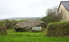
Quoit, Cornwall
Quoit is a settlement in mid Cornwall, United Kingdom. It is situated in the parish of St. Columb Major approximately one mile (2 km) southeast of the town of St Columb Major and 7 miles (12 km) east of Newquay. It lies between the A30 dual carriageway trunk road and the A39 road through St Columb Major.[1]
| Quoit | |
|---|---|
 Remains of Devil's Quoit | |
 Quoit Location within Cornwall | |
| Civil parish |
|
| Unitary authority | |
| Ceremonial county | |
| Region | |
| Country | England |
| Sovereign state | United Kingdom |
| Post town | ST. COLUMB |
| Postcode district | TR9 |
| Dialling code | 01637 |
| Police | Devon and Cornwall |
| Fire | Cornwall |
| Ambulance | South Western |
| UK Parliament |
|
Devil's Quoit
The hamlet derives its name from a dolmen known as "Devil's Quoit" (or "Arthur's Quoit") at grid reference SW92326193.[2] Although one support stone was removed in the 18th century, the dolmen was still standing in 1840.[2] It partially collapsed between 1840 and 1850. By the 20th century, the stones had been split and either deliberately buried or incorporated in surrounding hedges.[2]
References
- Ordnance Survey Landranger 200; Newquay, Bodmin & surrounding area, 1:50 000. 1988
- DEVILS QUOIT Archived June 10, 2015, at the Wayback Machine, Pastscape, retrieved 20 November 2013
This article is issued from Wikipedia. The text is licensed under Creative Commons - Attribution - Sharealike. Additional terms may apply for the media files.