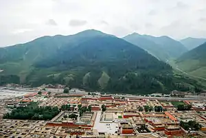
Qilian Mountains conifer forests
The Qilian Mountains Conifer Forests ecoregion (WWF ID:PA0517) is an ecoregion that consists of a series of isolated conifer forests on the northern slopes of the Qilian Mountain Range, on the northeast edge of the Tibetan Plateau in central China. [1]
| Ecoregion: Qilian Mountains Conifer Forests | |
|---|---|
 Labrang Monastery, in Xiahe County in the ecoregion | |
 Ecoregion territory (shown in purple) | |
| Ecology | |
| Realm | Palearctic |
| Biome | Temperate coniferous forest |
| Geography | |
| Area | 16,576 km2 (6,400 sq mi) |
| Countries | China |
| Coordinates | 34.35°N 103.79°E |
Location and description
The scattered patches of this ecoregion are thin ridges of forest between the Gobi Desert to the north, and the dry and high Tibetan Plateau to the south. The surrounding areas are alpine meadows and scrub.[1] The fragmented forests are found in isolated segments in the eastern Qilian Mountains, Daban Shan, the Amne Machin range, and Dié Shan. These segments are located in Qinghai and Gansu provinces.
Climate
Because of its high elevation and mid-continental location, the ecoregion's climate is Subarctic climate, dry winter (Köppen climate classification Subartic climate(Dwc)). This climate is characterized by mild summers (only 1–3 months above 10 °C or 50.0 °F) and cold winters having monthly precipitation less than one-tenth of the wettest summer month.[2][3] The average temperatures range from −18 to −7 °C (0 to 19 °F) in January, and 5 to 21 °C (41 to 70 °F) in July.[1]
Flora and fauna
The dominant trees in the ecoregion are the Qilian spruce (Picea crassifolia) and the Przewalski's juniper (Juniperus przewalskii). There are stands of short-stature bamboo in the understory. The relative isolation of the forests suggests that they may serve as habitat for a number of rare species of mammals, but the area is little studied and the presence of vulnerable species is unclear.[1]
References
- "Qilian Mountains Conifer Forests". World Wildlife Federation. Retrieved October 29, 2019.
- Kottek, M., J. Grieser, C. Beck, B. Rudolf, and F. Rubel, 2006. "World Map of Koppen-Geiger Climate Classification Updated" (PDF). Gebrüder Borntraeger 2006. Retrieved September 14, 2019.CS1 maint: multiple names: authors list (link)
- "Dataset - Koppen climate classifications". World Bank. Retrieved September 14, 2019.