Pethmakhama, Budgam
Pethmakhama is a village in Budgam district, in the Indian administrative union territory of Jammu and Kashmir. It falls under the administrative division of tehsil Magam. It is famous for the shrine of Mir Sayyid Ali Hamadani who stayed at various places in and around Kashmir and one example is Pethmakhama where he Prayed for around two months.[4] The stone on which he prayed there, has the marks of praying on it miraculously and is preserved at Aasir i Sharief Pethmakhama.[4] The shrine also hosts beard hair as one of the holy Relics of Muhammad which is displayed to the devotees every year on the auspicious occasion of Mehraj ul Alam[5] and other festivals.[6] Pethmakhama is irrigated throughout the year by River Sukhnag[7][8] which is a tributary of Jhelum River and various springs[9] in the village.
Pethmakhama | |
|---|---|
Village | |
 Aastan i Aaliyah Mir Sayyid Ali Hamadani Pethamkhama | |
 Pethmakhama Location in Budgam, Jammu and Kashmir  Pethmakhama Pethmakhama (India) | |
| Coordinates: 34°04′12″N 74°35′41″E[1] | |
| Country | India |
| State | Jammu and Kashmir |
| District | Budgam |
| Government | |
| • Sarpanch | Shakeela Bano |
| • Numberdar | Ab Rashid Dar |
| • Village Guard | Ghulam Rasool Ganai |
| Elevation | 1,740 m (5,710 ft) |
| Population (2011)[2] | |
| • Total | 4,646 |
| Languages | |
| • Spoken | Kashmiri |
| • Official | English and Urdu |
| Time zone | UTC+5:30 (IST) |
| PIN | 193401[3] |
| Area code(s) | +91-1954 BSNL Landline |
Demographics
According to the 2011 Census of India, 621 families reside in Pethmakhama, comprising a total population of 4,646; 21.42% of the population (995 people) are children aged 0–6. The average sex ratio is 959, higher than Jammu and Kashmir State's average of 889. There are 910 women for every 1000 men.[2] In 2011, the village literacy rate was 57.66%, compared to the 67.16% overall for Jammu and Kashmir. Male literacy stood at 65.64% while female literacy was 49.44%. According to the constitution of India and the Panchyati Raj Act., Pethmakhama village is administrated by Sarpanch (Head of Village), an elected representative of the village.[10]
Location
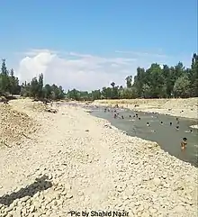
Pethmakhama is situated on the bank of the river Sukhnag,[11] about 23 km to the north of the district headquarters, Budgam.[12] The adjacent villages of Pethmakhama are Badran, Magam, Aripanthan, Rathson, Bonmakhama, and Kanihama.
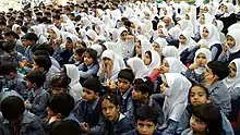
Schools
Transport
Roads
Pethmakhama is connected to Srinagar via Magam and is connected via Sanoor Kalipora to Budgam district headquarters. Beerwah 14 km away is connected to Pethmakhama via Aripanthan also via Rathsoon. It is also connected to Tehsil Khag via Aripanthan, 16 km (9.9 mi) away. The road connecting Pethmakhama with Magam was paved but remains with some potholes.[15]
Rails
The nearest railway stations are Mazhom railway station and Budgam railway station.
References
- "Maps, Weather, and Airports for Makahom, India". fallingrain.com. Retrieved 16 October 2015.
- "Peth Mekehama Village Population – Beerwah – Badgam, Jammu and Kashmir". census2011.co.in. Retrieved 16 October 2015.
- PostCodesDB. "193401 Peth Makhama India डाक कोड". postalcodesdb.com. Retrieved 16 October 2015.
- https://mykashmirvalley.wordpress.com/history-of-kashmir/
- https://theins.in/2019/04/04/mehraj-ul-alam-celebrated-with-religious-fervour-gaiety/amp/
- https://www.greaterkashmir.com/news/kashmir/meraj-ul-alam-celebrated-with-religious-fervour/%3famp
- https://www.hindawi.com/journals/jeco/2014/898054/
- https://www.tenderdetail.com/Indian-Tenders/TenderNotice/23039948/CC25737CC101F4933986FCAA5F26A7F7
- https://www.researchgate.net/publication/268485384_Statistical_Assessment_of_Water_Quality_Parameters_for_Pollution_Source_Identification_in_Sukhnag_Stream_An_Inflow_Stream_of_Lake_Wular_Ramsar_Site_Kashmir_Himalaya
- "Census of India 2011 : Jammu & Kashmir" (PDF). Censusindia.gov.in. Retrieved 16 October 2015.
- "Geography of Jammu and Kashmir State". koausa.org. Retrieved 16 October 2015.
- "Pethmakhama- Narbal". soki.in. Retrieved 16 October 2015.
- "List of govt Schools in peth makhama badgam jammu & kashmir – Edukistan". edukistan.com. Retrieved 16 October 2015.
- Link text, additional text.
- = 2014-2015 "Report on Delayed Muster Roll for Financial Year: 2014–2015" Check
|archive-url=value (help). 164.100.72.25. Archived from = 2014-2015 the original Check|url=value (help) (PDF) on 17 November 2015. Retrieved 16 October 2015.