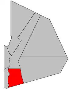
Perth Parish, New Brunswick
Perth is a civil parish in Victoria County, New Brunswick, Canada.[2]
Perth | |
|---|---|
 Location within Victoria County, New Brunswick. | |
| Coordinates: 46.69°N 67.62°W | |
| Country | |
| Province | |
| County | Victoria |
| Erected | 1833 |
| Area | |
| • Land | 318.25 km2 (122.88 sq mi) |
| Population (2016)[1] | |
| • Total | 1,082 |
| • Density | 3.4/km2 (9/sq mi) |
| • Pop 2006-2011 | |
| • Dwellings | 575 |
| Time zone | UTC-4 (AST) |
| • Summer (DST) | UTC-3 (ADT) |
For governance purposes it is divided between the village of Perth-Andover, the Indian reserve of Tobique 20, and the local service district of the parish of Perth.[3] The village and LSD are both members of the Western Valley Regional Service Commission (WVRSC).[4]
Origin of name
The parish may have been named for Perthshire, Scotland, birth county of Sir Archibald Campbell, Lieutenant Governor of New Brunswick at the time.
History
Perth was erected in 1833 in Carleton County from Kent Parish.[5] The parish included all of modern Victoria County east of the Saint John River and south of the Grand Falls.
In 1850 Victoria County was erected from Carleton County; the new county line ran through Perth, removing part of the parish.[6]
In 1854 the county line was moved to the pre-1850 southern line of Perth.[7]
In 1864 the eastern part of Perth was included in the newly erected Gordon Parish.[8] Three months later the pre-1854 county line was restored.[9]
Delineation
Perth Parish is defined in the Territorial Division Act[2] as being bounded:
- West by the Saint John River; north by a line run true east from the northwest angle of the Tobique Indian Reserve;[lower-alpha 1] east by Gordon Parish; and south by the County line.
Communities
Parish population total does not include incorporated municipalities (in bold):
|
|
|
Bodies of water
Bodies of water at least partly in the parish
- Saint John River
Demographics
Population
|
LanguageMother tongue (2016)[1]
|
See also
Notes
- Tobique 20
References
- "Census Profile, 2016 Census: Perth, Parish [Census subdivision], New Brunswick". Statistics Canada. Retrieved October 2, 2019.
- "Chapter T-3 Territorial Division Act". Government of New Brunswick. Retrieved 13 November 2020.
- "New Brunswick Regulation 84-168 under the Municipalities Act (O.C. 84-582)". Government of New Brunswick. Retrieved 23 July 2020.
- "Communities in each of the 12 Regional Service Commissions (RSC) / Les communautés dans chacune des 12 Commissions de services régionaux (CSR)" (PDF), Government of New Brunswick, July 2017, retrieved 1 February 2021
- "3 Wm. IV c. 17 An Act to divide the Parish of Kent, in the County of Carleton, into Five Towns or Parishes.". Acts of the General Assembly of His Majesty's Province of New Brunswick, Passed in the Year 1833. Fredericton: Government of New Brunswick. 1833. pp. 114–115.
- "13 Vic. c. 51 An Act to consolidate all the Laws now in force for the division of the Province into Counties, Towns and Parishes.". Acts of the General Assembly of Her Mjaesty's Province of New Brunswick, Passed in the Year 1850. Fredericton: Government of New Brunswick. 1850. pp. 142–152, 145–149. Book was poorly proofread, resulting in title typo and reuse of page numbers 145–152.
- "Chapter 1.". The Revised Statutes of New Brunswick Volume 1. Fredericton: Government of New Brunswick. 1854. pp. 2–19.
- "26 Vic. c. 44 An Act to erect parts of the Parishes of Grand Falls, Perth, and Saint Leonard, in the County of Victoria, into a separate Town or Parish.". Acts of the General Assembly of Her Majesty's Province of New Brunswick, Passed in the Month of April, 1863. Fredericton: Government of New Brunswick. 1863. p. 101.
- "27 Vic. c. 27 An Act to define the Boundaries between the Counties of Carleton and Victoria.". Acts of the General Assembly of Her Majesty's Province of New Brunswick, Passed in the Month of April 1864. Fredericton: Government of New Brunswick. 1864. pp. 50–51.
- Statistics Canada: 1996, 2001, 2006 census
- 2011 Statistics Canada Census Profile: Perth Parish, New Brunswick