Peria, Northland
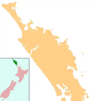
Peria or Pēria is a locality in Northland, New Zealand. It lies south of Taipa and east of Kaitaia. The area was once known as Oruru Valley.[1]
Peria | |
|---|---|
 Peria | |
| Coordinates: 35°5′54″S 173°29′17″E | |
| Country | New Zealand |
| Region | Northland Region |
| District | Far North District |
Wiremu Hoani Taua, who later became the first Maori person to be appointed as the head teacher of a native school, served on the Peria Native School Committee until 1900.[2]
Demographics
| Year | Pop. | ±% p.a. |
|---|---|---|
| 2006 | 1,011 | — |
| 2013 | 951 | −0.87% |
| 2018 | 1,107 | +3.08% |
| Source: [3] | ||
The statistical area of Peria, which at 199.69 square kilometres is much larger than the locality, had a population of 1,107 at the 2018 New Zealand census, an increase of 156 people (16.4%) since the 2013 census, and an increase of 96 people (9.5%) since the 2006 census. There were 423 households. There were 585 males and 522 females, giving a sex ratio of 1.12 males per female. Of the total population, 228 people (20.6%) were aged up to 15 years, 159 (14.4%) were 15 to 29, 540 (48.8%) were 30 to 64, and 177 (16.0%) were 65 or older. Figures may not add up to the total due to rounding.
Ethnicities were 74.3% European/Pākehā, 40.1% Māori, 3.0% Pacific peoples, 2.7% Asian, and 2.7% other ethnicities. People may identify with more than one ethnicity.
The percentage of people born overseas was 14.4, compared with 27.1% nationally.
Although some people objected to giving their religion, 52.3% had no religion, 30.4% were Christian, and 8.7% had other religions.
Of those at least 15 years old, 108 (12.3%) people had a bachelor or higher degree, and 183 (20.8%) people had no formal qualifications. The median income was $19,600. The employment status of those at least 15 was that 324 (36.9%) people were employed full-time, 126 (14.3%) were part-time, and 60 (6.8%) were unemployed.[3]
Education
Peria School is a coeducational full primary (years 1-8) school with a decile rating of 2 and a roll of 78.[4]
The local marae, Te Kauhanga, and its meeting house, Te Poho o Ngāti Kahu, are a tribal meeting place for the Ngāti Kahu hapū of Te Paatu ki Pēria.[5][6]
Notes
- "Peria Valley". Archived from the original on 4 July 2007. Retrieved 23 January 2008.
- "Taua, Wiremu Hoani". Dictionary of New Zealand Biography.
- "Statistical area 1 dataset for 2018 Census". Statistics New Zealand. March 2020. Peria (101300). 2018 Census place summary: Peria
- "Te Kete Ipurangi - Peria School". Ministry of Education. Archived from the original on 29 September 2007. Retrieved 23 January 2008.
- "Te Kāhui Māngai directory". tkm.govt.nz. Te Puni Kōkiri.
- "Māori Maps". maorimaps.com. Te Potiki National Trust.