National Register of Historic Places listings in Columbia County, Florida
This is a list of the National Register of Historic Places listings in Columbia County, Florida.
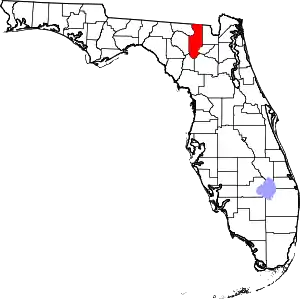
Location of Columbia County in Florida
This is intended to be a complete list of the properties and districts on the National Register of Historic Places in Columbia County, Florida, United States. The locations of National Register properties and districts for which the latitude and longitude coordinates are included below, may be seen in a map.[1]
There are 12 properties and districts listed on the National Register in the county.
- This National Park Service list is complete through NPS recent listings posted January 29, 2021.[2]
| Alachua - Baker - Bay - Bradford - Brevard - Broward - Calhoun - Charlotte - Citrus - Clay - Collier - Columbia - DeSoto - Dixie - Duval - Escambia - Flagler - Franklin - Gadsden - Gilchrist - Glades - Gulf - Hamilton - Hardee - Hendry - Hernando - Highlands - Hillsborough (Tampa) - Holmes - Indian River - Jackson - Jefferson - Lafayette - Lake - Lee - Leon - Levy - Liberty - Madison - Manatee - Marion - Martin - Miami-Dade (Miami) - Monroe - Nassau - Okaloosa - Okeechobee - Orange - Osceola - Palm Beach - Pasco - Pinellas - Polk - Putnam - St. Johns - St. Lucie - Santa Rosa - Sarasota - Seminole - Sumter - Suwannee - Taylor - Union - Volusia - Wakulla - Walton - Washington |
Current listings
| [3] | Name on the Register[4] | Image | Date listed[5] | Location | City or town | Description |
|---|---|---|---|---|---|---|
| 1 | Columbia County High School |  Columbia County High School |
November 15, 1993 (#93001154) |
372 West Duval Street 30°11′20″N 82°38′27″W |
Lake City | Part of the Lake City MPS |
| 2 | Horace Duncan House |  Horace Duncan House |
November 15, 1993 (#93001155) |
202 West Duval Street 30°11′19″N 82°38′20″W |
Lake City | Part of the Lake City MPS |
| 3 | Falling Creek Methodist Church and Cemetery |  Falling Creek Methodist Church and Cemetery |
April 4, 1996 (#96000359) |
State Road 131, 6 miles northwest of Lake City 30°15′32″N 82°39′52″W |
Lake City | |
| 4 | Fort White Public School Historic District |  Fort White Public School Historic District |
December 1, 1989 (#89002061) |
East Dorch at North Bryant Street 29°55′32″N 82°42′45″W |
Fort White | |
| 5 | Goodbread-Black Farm Historic District | April 1, 1999 (#99000409) |
Off Corinth Road, south of the Suwannee River, east of U.S. Route 41, and west of U.S. Route 441 30°18′46″N 82°39′03″W |
Lake City | On private property and gated | |
| 6 | T. G. Henderson House |  T. G. Henderson House |
July 24, 1973 (#73000571) |
207 South Marion Street 30°11′15″N 82°38′14″W |
Lake City | |
| 7 | Hotel Blanche | .JPG.webp) Hotel Blanche |
January 18, 1990 (#89002320) |
212 North Marion Street 30°11′27″N 82°38′16″W |
Lake City | |
| 8 | Lake City Historic Commercial District |  Lake City Historic Commercial District |
June 6, 1994 (#93001157) |
Roughly bounded by Railroad, North Hernando, Duval, and North Columbia Streets 30°11′32″N 82°38′14″W |
Lake City | Part of the Lake City MPS |
| 9 | Lake Isabella Historic Residential District |  Lake Isabella Historic Residential District |
November 15, 1993 (#93001156) |
Roughly bounded by East, Duval, and Columbia Streets, Baya Avenue, Church Street, and Lake Isabella 30°11′09″N 82°38′04″W |
Lake City | Part of the Lake City MPS |
| 10 | McKeithen Archaeological Site | September 14, 2020 (#100005551) |
Address Restricted |
Wellborn vicinity | ||
| 11 | O'Leno State Park |  O'Leno State Park |
June 9, 2014 (#14000282) |
410 SE. O'Leno Park Rd. 29°55′18″N 82°36′31″W |
High Springs | |
| 12 | Sikes House |  Sikes House |
February 1, 2007 (#06001318) |
288 Ellis Street, just south of U.S. Route 27 29°55′21″N 82°42′48″W |
Fort White |
See also
| Wikimedia Commons has media related to National Register of Historic Places in Columbia County, Florida. |
References
- The latitude and longitude information provided in this table was derived originally from the National Register Information System, which has been found to be fairly accurate for about 99% of listings. Some locations in this table may have been corrected to current GPS standards.
- "National Register of Historic Places: Weekly List Actions". National Park Service, United States Department of the Interior. Retrieved on January 29, 2021.
- Numbers represent an alphabetical ordering by significant words. Various colorings, defined here, differentiate National Historic Landmarks and historic districts from other NRHP buildings, structures, sites or objects.
- "National Register Information System". National Register of Historic Places. National Park Service. March 13, 2009.
- The eight-digit number below each date is the number assigned to each location in the National Register Information System database, which can be viewed by clicking the number.
Municipalities and communities of Columbia County, Florida, United States | ||
|---|---|---|
| City | | |
| Town | ||
| CDPs | ||
| Unincorporated communities | ||
| ||
This article is issued from Wikipedia. The text is licensed under Creative Commons - Attribution - Sharealike. Additional terms may apply for the media files.