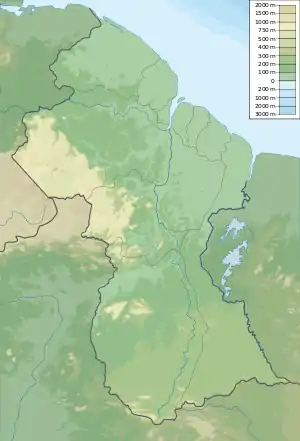
Merume River
The Merume River is a river of Guyana, a tributary of the Kamarang River.
| Merume River | |
|---|---|
 | |
| Location | |
| Country | Guyana |
| Physical characteristics | |
| Mouth | Kamarang River |
Merume is also the name of a nearby mountain,[1] which is 30 miles east of Mount Roraima.[2] Director Creek is a tributary of Merume River. First Falls is a feature of the river which also limits travel by boat.[3]
Merumite was discovered in 1937 appearing as black grains among diamonds and gold in the river gravel.[3] In 1958, merumite was determined to be a complex aggregate of eskolaite and chromium, X-ray diffraction data showed it contained eskolaite, guyanaite, bracewellite, grimaldiite, and mcconnellite.[4]
Kamakusa was a settlement along the river, and formerly a government center.[3]
See also
References
- Whitely, Henry (1884). "Explorations in the Neighbourhood of Mounts Roraima and Kukenam, in British Guiana". Proceedings of the Royal Geographical Society and Monthly Record of Geography. 6 (8): 452. doi:10.2307/1800725. ISSN 0266-626X.
- Tate, G. H. H. (1930). "Notes on the Mount Roraima Region". Geographical Review. 20 (1): 61. doi:10.2307/209126. ISSN 0016-7428.
- Milton, Charles; Narain, Sat (1969-12-01). "Merumite occurrence in Guyana". Economic Geology. 64 (8): 910–914. doi:10.2113/gsecongeo.64.8.910. ISSN 1554-0774.
- Shpachenko, A. K.; Sorokhtina, N. V.; Chukanov, N. V.; Gorshkov, A. N.; Sivtsov, A. V. (2006-07-01). "Genesis and compositional characteristics of natural γ-CrOOH". Geochemistry International. 44 (7): 681–689. doi:10.1134/S0016702906070056. ISSN 1556-1968.
Bibliography
- Rand McNally, The New International Atlas, 1993.
This article is issued from Wikipedia. The text is licensed under Creative Commons - Attribution - Sharealike. Additional terms may apply for the media files.