List of nature reserves in the Republic of Ireland
The lists below shows the names and locations of nature reserves in Ireland. A nature reserve in Ireland is a designated area of importance to wildlife, protected by a ministerial order. The majority of these reserves are owned by the state, but some are under the ownership of organisations or in private ownership.[1] The first reserves were established under the 1976 Wildlife Act. They are designated and managed by the National Parks and Wildlife Division of Duchas and Department of Culture, Heritage and Gaeltacht. All these designated reserves are Natural Heritage Areas (NHAs), with some of them also listed as Special Areas of Conservation (SACs).[2]
This is a list of nature reserves in Ireland.
Connacht
| Nature reserve | Photo | County | Land area (hectares) | Owner | Established | Coordinates |
|---|---|---|---|---|---|---|
| Ballynastaig Wood |  |
Galway | 9.758 | State | 1983 | 53.097°N 8.864°W |
| Clochar na gCon/Bealacooan Bog | Galway | 1247 | State | 1999 | 53.271°N 9.428°W | |
| Coole Garryland |  |
Galway | 363.583 | State | 1983 | 53.083°N 8.856°W |
| Derryclare | 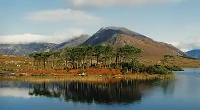 |
Galway | 19 | State | 1980 | 53.484°N 9.758°W |
| Derrycrag Wood | Galway | 110.477 | State | 1983 | 53.044°N 8.387°W | |
| Leam West Bog | Galway | 373.48 | State | 1991 | 53.423°N 9.489°W | |
| Pollnaknockaun Wood | Galway | 38.85 | State | 1983 | 53.063°N 8.388°W | |
| Rosturra Wood | Galway | 17.68 | State | 1983 | 53.06°N 8.355°W | |
| Richmond Esker | Galway | 15.7 | State | 1985 | 53.532°N 8.617°W | |
| Knockmoyle Sheskin | Mayo | 1198 | State | 1990 | 54.18°N 9.553°W | |
| Oldhead Wood | 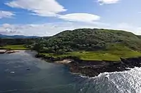 |
Mayo | 17 | State | 1984 | 53.776°N 9.779°W |
| Owenboy | Mayo | 397.1 | State | 1986 | 54.093°N 9.456°W | |
| Ballygilgan |  |
Sligo | 29.5 | State | 1986 | 54.341°N 8.548°W |
| Easkey Bog | Sligo | 607 | State | 1990 | 54.189°N 8.813°W |
Leinster
Munster
| Nature reserve | Photo | County | Land area (hectares) | Owner | Established | Coordinates |
|---|---|---|---|---|---|---|
| Ballyteigue |  |
Clare | 6.4 | State | 1986 | 53.026°N 9.266°W |
| Cahermurphy | Clare | 9 | State | 1980 | 53°N 8.642°W | |
| Dromore | 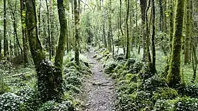 |
Clare | 370 | State | 1985 | 52.931°N 8.957°W |
| Keelhilla, Slieve Carron | 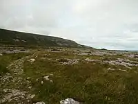 |
Clare | 145.5 | State | 1986 | 53.086°N 8.997°W |
| Capel Island and Knockadoon Head | Cork | 16.1 | Private | 1985 | 51.88°N 7.861°W | |
| Capel Island and Knockadoon Head |  |
Cork | 126.9 | State | 1985 | |
| Glengarriff Wood |  |
Cork | 301 | State | 1991 | 51.752°N 9.575°W |
| Kilcolman Bog | Cork | 21.398 | Private | 1993 | 52.247°N 8.613°W | |
| Kilcolman Bog | Cork | 29.287 | State | 1993 | ||
| Knockomagh Wood | Cork | 12.5 | State | 1989 | 51.506°N 9.31°W | |
| Lough Hyne | 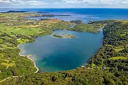 |
Cork | 65 | State | 1981 | 51.502°N 9.304°W |
| The Gearagh |  |
Cork | 300 | Private | 1987 | 51.885°N 8.999°W |
| Castlemaine Harbour | 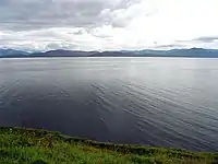 |
Kerry | 923 | State | 1990 | 52.128°N 9.944°W |
| Cummeragh River Bog | Kerry | 45.55 | State | 1994 | 51.871°N 10.065°W | |
| Derrycunnihy Wood |  |
Kerry | 136 | Private | 1989 | 51.971°N 9.594°W |
| Derrymore Island | Kerry | 106.07 | Private | 1989 | 52.255°N 9.83°W | |
| Eirk Bog |  |
Kerry | 16 | State | 1986 | 51.946°N 9.666°W |
| Great Skellig | .jpg.webp) |
Kerry | 22.6 | State | 1988 | 51.771°N 10.54°W |
| Little Skellig | .jpg.webp) |
Kerry | 7.8 | Private | 1988 | 51.782°N 10.509°W |
| Lough Nambrackdarrig |  |
Kerry | 3.9 | State | 1988 | 52.082°N 9.898°W |
| Lough Yganavan |  |
Kerry | 25.3 | State | 1988 | 52.093°N 9.893°W |
| Mount Brandon |  |
Kerry | 461.75 | State | 1986 | 52.268°N 10.237°W |
| Puffin Island |  |
Kerry | 53.77 | Private | 1987 | 51.837°N 10.408°W |
| Puffin Island | Kerry | 32.73 | State | 1987 | ||
| Sheheree Bog | Kerry | 8.9 | Private | 1990 | 52.04°N 9.481°W | |
| Tearaght Island |  |
Kerry | 27.5 | Private | 1989 | 52.075°N 10.665°W |
| Tearaght Island | Kerry | 19.1 | State | 1989 | ||
| Tralee Bay | .jpg.webp) |
Kerry | 754.53 | State | 1989 | 52.255°N 9.801°W |
| Uragh Wood |  |
Kerry | 87 | State | 1982 | 51.804°N 9.686°W |
| Redwood Bog | Tipperary | 132 | State | 1991 | 53.154°N 8.078°W | |
| Fenor Bog | 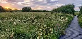 |
Waterford | 15.55 | Private | 2004 | 52.165°N 7.225°W |
Ulster
| Nature reserve | Photo | County | Land area (hectares) | Owner | Established | Coordinates |
|---|---|---|---|---|---|---|
| Ballyarr Wood | Donegal | 30 | State | 1986 | 55.029°N 7.712°W | |
| Derkmore Wood | Donegal | 8.7 | State | 1988 | 54.838°N 8.291°W | |
| Duntally Wood | Donegal | 15.3 | State | 1986 | 55.118°N 7.9°W | |
| Lough Barra Bog | Donegal | 176.4 | State | 1987 | 54.946°N 8.112°W | |
| Meenachullion Bog | Donegal | 194 | State | 1990 | 54.902°N 8.119°W | |
| Pettigo Plateau | Donegal | 900 | State | 1984 | 54.616°N 7.946°W | |
| Rathmullen Wood | Donegal | 32.73 | State | 1986 | 55.09°N 7.563°W |
See also
References
- "Nature Reserves in Ireland". National Parks & Wildlife Service. Retrieved 2020-05-22.
- "Statutory Nature Reserve – A guide to Irelands protected habitats & species". Conserve Ireland. Retrieved 2020-05-22.
This article is issued from Wikipedia. The text is licensed under Creative Commons - Attribution - Sharealike. Additional terms may apply for the media files.
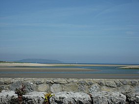
.jpg.webp)






_p057_Vale_of_Clara.jpg.webp)