List of lighthouses in the Channel Islands

This is a list of lighthouses in the Channel Islands. The archipelago lies to the west of the Cotentin Peninsula in the English Channel. There are lighthouses on all of the four main islands: Alderney, Guernsey, Jersey and Sark.[1][2][3]

Channel Islands

Lighthouses

Name Image Location &
coordinates
Island Year built Tower height Focal height Notes
Alderney LighthouseAlderney
49.7292°N 2.1643°W / 49.7292; -2.1643 (Alderney Lighthouse)
Alderney191232 m (105 ft)37 m (121 ft)
Bréhon TowerLittle Roussel
49.4713°N 2.4883°W / 49.4713; -2.4883 (Brehon Tower)
Guernsey18567 m (23 ft)19 m (62 ft)
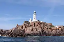
La CorbièreSaint Brélade
49.1804°N 2.2458°W / 49.1804; -2.2458 (La Corbiere)
Jersey187419 m (62 ft)36 m (118 ft)
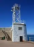
St Catherines BreakwaterSaint Martin, Jersey
49.2221°N 2.0107°W / 49.2221; -2.0107 (St Catherines Breakwater)
JerseyUnknown9 m (30 ft)18 m (59 ft)
Crocq PierheadSaint Sampson, Guernsey
49.4829°N 2.5165°W / 49.4829; -2.5165 (Crocq Pierhead)
GuernseyUnknown6 m (20 ft)11 m (36 ft)
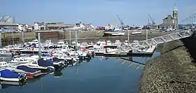
Castle BreakwaterSaint Peter Port Harbour
49.4549°N 2.5242°W / 49.4549; -2.5242 (Castle Breakwater)
Guernsey1850s12 m (39 ft)14 m (46 ft)
Casquets lighthousesLes Casquets
49.7219°N 2.3769°W / 49.7219; -2.3769 (Casquets lighthouse)
Alderney172423 m (75 ft)37 m (121 ft)
Demie de PasSaint Helier
49.1503°N 2.1025°W / 49.1503; -2.1025 (Demie de Pas)
Jersey190413 m (43 ft)11 m (36 ft)
Gorey PierGorey, Jersey
49.1968°N 2.0223°W / 49.1968; -2.0223 (Gorey Pier)
Jersey19669 m (30 ft)8 m (26 ft)
Greve d'AzetteSaint Helier
49.1686°N 2.0844°W / 49.1686; -2.0844 (Greve d'Azette)
Jersey189619 m (62 ft)23 m (75 ft)
Les Hanois LighthouseLes Hanois
49.4336°N 2.7003°W / 49.4336; -2.7003 (Les Hanois Lighthouse)
Guernsey186236 m (118 ft)34 m (112 ft)
St Martins PointJerbourg Point
49.4218°N 2.5283°W / 49.4218; -2.5283 (St Martins Point)
GuernseyUnknown5 m (16 ft)15 m (49 ft)
Noirmont Point LightSaint Brélade
49.1652°N 2.1681°W / 49.1652; -2.1681 (Noirmont Point)
Jersey191510 m (33 ft)18 m (59 ft)
Platte FougereSaint Sampson, Guernsey
49.5141°N 2.4852°W / 49.5141; -2.4852 (Platte Fougere)
Guernsey191025 m (82 ft)25 m (82 ft)
PlatteLittle Roussel
49.4875°N 2.4979°W / 49.4875; -2.4979 (Platte)
GuernseyUnknown6 m (20 ft)9 m (30 ft)
RoustelLittle Roussel
49.4872°N 2.4803°W / 49.4872; -2.4803 (Roustel)
Guernsey19708 m (26 ft)10 m (33 ft)
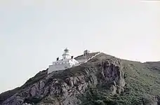
Sark LighthousePoint Robert
49.4364°N 2.3455°W / 49.4364; -2.3455 (Sark Lighthouse)
Sark191317 m (56 ft)65 m (213 ft)
Sorel PointVingtaine du Douet (St John)
49.2601°N 2.1589°W / 49.2601; -2.1589 (Sorel Point)
Jersey19383 m (10 ft)50 m (164 ft)
St Sampsons South Pier,
Range Rear
Saint Sampson, Guernsey
49.4825°N 2.5177°W / 49.4825; -2.5177 (South Pier Range Rear)
Guernsey187412 m (39 ft)13 m (43 ft)
TautenayHerm
49.5017°N 2.4469°W / 49.5017; -2.4469 (Tautenay)
HermUnknown8 m (26 ft)7 m (23 ft)
Mount UbeSaint Helier
49.1716°N 2.0601°W / 49.1716; -2.0601 (Mount Ube)
Jersey189614 m (46 ft)46 m (151 ft)
Victoria MarinaSaint Peter Port Harbour
49.4554°N 2.5340°W / 49.4554; -2.5340 (Victoria Marina)
GuernseyUnknown7 m (23 ft)10 m (33 ft)
White Rock PierSaint Peter Port Harbour
49.4563°N 2.5265°W / 49.4563; -2.5265 (White Rock Pier)
Guernsey190810 m (33 ft)11 m (36 ft)

See also

  • Lists of lighthouses and lightvessels

References

This article is issued from Wikipedia. The text is licensed under Creative Commons - Attribution - Sharealike. Additional terms may apply for the media files.