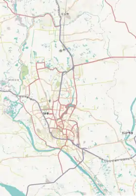
List of districts and suburbs of Dhaka
Dhaka (/ˈdɑːkə/ DAH-kə or /ˈdækə/ DAK-ə, Bengali: [ˈɖʱaka]), formerly known as Dacca,[8] is the capital of Bangladesh. It is the ninth-largest and the sixth-most densely populated city in the world, with a population of 8.9 million residents within the city limits, and a population of over 21 million residents in the Greater Dhaka Area. Dhaka is the economic, political, and cultural center of Bangladesh, and is one of the major cities in South Asia, the largest city in Eastern South Asia
Dhaka
ঢাকা Dacca | |
|---|---|
.jpg.webp) .jpg.webp)    .jpg.webp) From top: View of Paltan Sangsad Bhaban in Sher-e-Bangla Nagar, Ahsan Manzil in Old Dhaka, Curzon Hall at University of Dhaka, Lalbagh Fort, aerial view of Hatirjheel lakefront | |
 Dhaka Location of Dhaka in Dhaka Division, Bangladesh  Dhaka Dhaka (Dhaka division)  Dhaka Dhaka (Bangladesh)  Dhaka Dhaka (Asia) .svg.png.webp) Dhaka Dhaka (Earth) | |
| Coordinates: 23°45′50″N 90°23′20″E | |
| Country | |
| Division | Dhaka Division |
| District | Dhaka District |
| Establishment | 1608 CE |
| Granted city status | 1947 |
| Government | |
| • Type | Mayor - Council |
| • Body | DNCC and DSCC |
| • North City Mayor | Atiqul Islam[1] |
| • South City Mayor | Sheikh Fazle Noor Taposh[1] |
| Area | |
| • Urban | 306 km2 (118 sq mi) |
| • Metro | 2,161.17[4] km2 (834.432[4] sq mi) |
| Elevation | 4 m (13.12 ft) |
| Population | |
| • Capital of Bangladesh | 8,906,039 |
| • Rank | 1st |
| • Density | 46,997/km2 (121,720/sq mi) |
| • Metro | 21,006,000 |
| Demonym(s) | Dhakaite, Dhakaiya |
| Time zone | UTC+6 (BST) |
| Postal code | 1000, 1100, 12xx, 13xx |
| National calling code | +880 |
| Calling code | 02 [For Dhaka city only] |
| Police | Dhaka Metropolitan Police |
| International airport | Hazrat Shahjalal International Airport |
| ISO 3166-2 | BD-13 |
| Website | Dhaka North City Corporation Dhaka South City Corporation |
Below is a list of districts, neighborhoods, and suburbs of the city of Dhaka.
Dhaka North

- Abdullahpur
- Uttara
- Mirpur
- Pallabi
- Kazipara
- Kafrul
- Agargaon
- Sher-e-Bangla Nagar
- Cantonment area
- Banani
- Gulshan
- Mohakhali
- Bashundhara
- Banasree
- Baridhara
- Uttarkhan
- Dakshinkhan
- Bawnia
- Khilkhet
- Tejgaon
- Farmgate
- Mohammadpur
- Rampura
- Badda
- Satarkul
- Beraid
- Khilgaon
- Tejgaon
- Gabtali
Dhaka South

Suburbs outside of Dhaka
Purbachal
.jpg.webp)
Purbachal Residential Model Town is the biggest planned township in Bangladesh.[9] The project area consists of about 6,227 acres (25 square kilometer) land located in between the Shitalakhya and the Balu River at Rupgonj thana of Narayanganj District and at Kaligonj Thana of Gazipur District, in the northeastern side of Dhaka.
Other suburbs
- Tongi
- Ashulia
- Fatullah
- Birulia
- Jinjira
- Siddhirganj
- Jhilmil
References
- "Hasan Mahmud states 3 reasons behind low voter turnout". The Daily Star. UNB. 2 February 2020. Archived from the original on 2 February 2020. Retrieved 2 February 2020.
- Partha Pratim Bhattacharjee; Mahbubur Rahman Khan (7 May 2016). "Govt to double size of Dhaka city area". The Daily Star. Archived from the original on 2 March 2017. Retrieved 1 March 2017.
- "Dhaka City expands by more than double after inclusion of 16 union councils". bdnews24.com. 9 May 2016. Archived from the original on 2 March 2017. Retrieved 1 March 2017.
- "Dhaka Metropolitan City Area". Archived from the original on 29 September 2017. Retrieved 29 September 2017.
- "Dhaka, Bangladesh Map". National Geographic. Archived from the original on 7 January 2010. Retrieved 6 September 2009.
- Archived 30 July 2017 at the Wayback Machine sum for 41 thanas of Dhaka city, not including 5 upazilas of Dhaka district
- "Population & Housing Census-2011" (PDF). Bangladesh Bureau of Statistics. p. 41. Archived from the original (PDF) on 8 December 2015. Retrieved 15 December 2015.
- Choguill, C.L. (2012). New Communities for Urban Squatters: Lessons from the Plan That Failed in Dhaka, Bangladesh. Springer Science & Business Media. p. viii. ISBN 978-1-4613-1863-7. Archived from the original on 5 June 2020. Retrieved 10 July 2016.
- "Purbachal New Town".