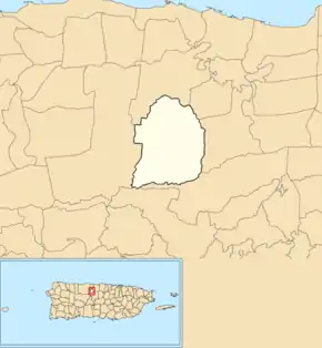
List of barrios and sectors of Florida, Puerto Rico
Like all municipalities of Puerto Rico, Florida is subdivided into administrative units called barrios, which are roughly comparable to minor civil divisions,[1] (and means wards or boroughs or neighborhoods in English). The barrios and subbarrios,[2] in turn, are further subdivided into smaller local populated place areas/units called sectores (sectors in English). The types of sectores may vary, from normally sector to urbanización to reparto to barriada to residencial, among others.[3][4][5][6][7][8] A newer municipality of Puerto Rico, Florida has one barrio called Florida Adentro and two subbarrios: Florida Zona Urbana and Pajonal and it does not have a barrio-pueblo like most of the other municipalities of Puerto Rico.[9][10][11]

The following areas are neighborhoods in Florida:
- Parcelas Arroyo
- Parcelas Selgas
- Pueblo Viejo
- San Agustín
- Perol
- Tosas
List of sectors by barrio
Florida Adentro
- Alturas de Yanes 2da.
- Alturas de Yanes 3ra.
- Florida Gardens Apartments
- Avenida Heriberto González (Carretera 6642)
- Calle Antonio Alcázar
- Calle Charlie Montoyo
- Calle Delicias
- Calle Julio Reina (formerly Extensión Calle Jazmín)
- Calle Manuel Colón
- Calle Roberto González
- Calle Valle Verde
- Carretera 140
- Comunidad Alturas de Pajonal
- Comunidad Arroyo
- Comunidad La Fuente
- Edificio Mieses
- Égida de Florida
- Extensión Selgas (Los Quemaos)
- Parcelas Alturas de Yanes 1ra.
- Parcelas Selgas I
- Parcelas Selgas II
- Reparto Ceiba
- Reparto Diana
- Reparto Martínez
- Reparto Rita Mar
- Reparto San Agustín
- Residencial Villas de Florida
- Residencial Florida Housing
- Sector Aguacate
- Sector Ceiba
- Sector Comisión
- Sector Dorta
- Sector El Hoyo
- Sector Fogones
- Sector Juana Gómez
- Sector La Maldonado
- Sector La Vázquez
- Sector La Villamil
- Sector Los Guanos
- Sector Los Mangoses
- Sector Pajonal
- Sector Perol
- Sector Pueblo Viejo
- Sector Pueblo
- Sector Puerto Blanco
- Sector Riachuelo
- Sector San Agustín
- Sector San José
- Sector San Luis
- Sector Tosas
- Sector Valle Encantado
- Urbanización Altos de Florida
- Urbanización Altos de Florida II
- Urbanización Alturas de Florida
- Urbanización Colinas de Lourdes
- Urbanización Country Hills
- Urbanización Estancias de Arroyo
- Urbanización Estancias de Florida
- Urbanización Estancias de la Ceiba
- Urbanización Estancias de Lourdes
- Urbanización Haciendas Florida
- Urbanización Jardines de Florida
- Urbanización Las Flores
- Urbanización San José
- Urbanización Seoane
- Urbanización Vegas de Florida
See also
References
- "US Census Barrio-Pueblo definition". factfinder.com. US Census. Archived from the original on 13 May 2017. Retrieved 5 January 2019.
- "P.L. 94-171 VTD/SLD Reference Map (2010 Census): Florida Municipio, PR" (PDF). www2.census.gov. U.S. DEPARTMENT OF COMMERCE Economics and Statistics Administration U.S. Census Bureau. Archived (PDF) from the original on 22 August 2020. Retrieved 22 August 2020.
- "PRECINTO ELECTORAL FLORIDA 024" (PDF). Comisión Estatal de Elecciones (in Spanish). PR Government. 19 October 2018. Archived (PDF) from the original on 15 June 2020. Retrieved 21 June 2019.
- Mari Mut, José A. (28 August 2013). "Los pueblos de Puerto Rico y las iglesias de sus plazas" (in Spanish). Retrieved 19 June 2020 – via archive.org.
- "Agencia: Oficina del Coordinador General para el Financiamiento Socioeconómico y la Autogestión (Proposed 2016 Budget)". Puerto Rico Budgets (in Spanish). Archived from the original on 28 June 2019. Retrieved 28 June 2019.
- Rivera Quintero, Marcia (2014), El vuelo de la esperanza : Proyecto de las Comunidades Especiales Puerto Rico, 1997-2004 (Primera edición ed.), San Juan, Puerto Rico Fundación Sila M. Calderón, ISBN 978-0-9820806-1-0
- "Leyes del 2001". Lex Juris Puerto Rico (in Spanish). Archived from the original on 14 September 2018. Retrieved 24 June 2019.
- "Comunidades Especiales de Puerto Rico" (in Spanish). 8 August 2011. Archived from the original on 24 June 2019. Retrieved 24 June 2019.
- Gwillim Law (20 May 2015). Administrative Subdivisions of Countries: A Comprehensive World Reference, 1900 through 1998. McFarland. p. 300. ISBN 978-1-4766-0447-3. Retrieved 25 December 2018.
- Puerto Rico:2010:population and housing unit counts.pdf (PDF). U.S. Dept. of Commerce, Economics and Statistics Administration, U.S. Census Bureau. 2010. Archived (PDF) from the original on 20 February 2017. Retrieved 11 January 2019.
- "Map of Florida at the Wayback Machine" (PDF). Archived from the original (PDF) on 2018-03-24. Retrieved 2018-12-29.