List of National Wild and Scenic Rivers
This is a list of the designated National Wild and Scenic Rivers in the United States. Some rivers may be listed more than once if they have designated sections in different states.

The Wolf River in Wisconsin
Initials of the managing agency follow the name of the river. Abbreviations used are:
- USACE = U.S. Army Corps of Engineers
- BLM = Bureau of Land Management
- NPS = National Park Service
- USFS = U.S. Forest Service
- USFWS = U.S. Fish & Wildlife Service
Alabama
Alaska

Andreafsky River in Alaska

Tlikakila River
- Alagnak River, NPS
- Alatna River, NPS
- Andreafsky River, USFWS
- Aniakchak River, NPS
- Beaver Creek, BLM/USFWS
- Birch Creek, BLM
- Charley River, NPS
- Chilikadrotna River, NPS
- Delta River, BLM
- Fortymile River, BLM
- Gulkana River, BLM
- Ivishak River, USFWS
- John River, NPS
- Kobuk River, NPS
- Mulchatna River, NPS
- Noatak River, NPS
- North Fork Koyukuk River, NPS
- Nowitna River, USFWS
- Salmon River, NPS
- Selawik River, USFWS
- Sheenjek River, USFWS
- Tinayguk River, NPS
- Tlikakila River, NPS
- Unalakleet River, BLM
- Wind River, USFWS

Arkansas
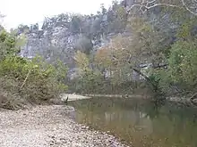
The Buffalo National River in Arkansas
- Big Piney Creek, USFS
- Buffalo River, NPS
- Cossatot River, USACE/USFS/Arkansas
- Hurricane Creek, USFS
- Little Missouri River, USFS
- Mulberry River, USFS
- North Sylamore Creek, USFS
- Richland Creek, USFS
California

Trinity River in California
- Amargosa River, added in 2009
- American River, California/BLM/USFS
- Bautista Creek, USFS[1]
- Big Sur River, USFS
- Black Butte River, USFS (Added in 2005)
- Cottonwood Creek, USFS
- Eel River, BLM/USFS/California
- Feather River, USFS
- Fuller Mill Creek, USFS
- Kern River, NPS/USFS
- Kings River, USFS
- Klamath River, BLM/NPS/USFS/California
- Merced River, BLM/NPS/USFS
- Middle Fork Kings River, NPS/USFS
- North Fork Salmon River, USFS
- Owens River Headwaters, USFS[2]
- Palm Canyon Creek, USFS[3]
- Piru Creek, USFS[3]
- Salmon River, USFS
- San Jacinto River (North Fork), USFS[3]
- Sespe Creek, USFS
- Sisquoc River, USFS
- Smith River, USFS/California
- South Fork Kings River, NPS/USFS
- South Fork Salmon River, USFS
- Trinity River, BLM/USFS/California
- Tuolumne River, BLM/NPS/USFS
- Wooley Creek, USFS
Colorado
- Cache La Poudre River, NPS/USFS
Connecticut
- Eightmile River, NPS
- Farmington River (West Branch), NPS/Connecticut
Delaware
- White Clay Creek, NPS/Local Government

Georgia
- Chattooga River, USFS
Idaho

Salmon River, Idaho
- Battle Creek, BLM
- Big Jacks Creek, BLM
- Bruneau River, BLM
- Bruneau River (West Fork), BLM
- Clearwater River (Middle Fork), USFS
- Cottonwood Creek, BLM
- Deep Creek, BLM
- Dickshooter Creek, BLM
- Duncan Creek, BLM
- Jarbidge River, BLM
- Little Jacks Creek, BLM
- Lochsa River, USFS
- Owyhee River, BLM
- Owyhee River (North Fork), BLM
- Owyhee River (South Fork), BLM
- Rapid River, USFS
- Red Canyon, BLM
- Saint Joe River, USFS
- Salmon River, USFS
- Salmon River (Middle Fork), USFS
- Selway River, USFS
- Sheep Creek, BLM
- Snake River, USFS
- Wickahoney Creek, BLM
Illinois
- Middle Fork of the Vermilion River, Illinois.
Kentucky
- Red River, USFS
Louisiana
- Saline Bayou, USFS
Maine
- Allagash Wilderness Waterway, Maine
Massachusetts

Taunton River
- Sudbury River, Assabet River and Concord River, NPS/Massachusetts/Local Government
- Taunton River, Massachusetts
- Westfield River, Massachusetts
Michigan
- Au Sable River, USFS
- Bear Creek, USFS
- Black River, USFS
- Carp River, USFS
- Indian River, USFS
- Manistee River, USFS
- Ontonagon River, USFS
- Paint River, USFS
- Pere Marquette River, USFS
- Pine River, USFS
- Presque Isle River, USFS
- Sturgeon River (Hiawatha National Forest), USFS
- Sturgeon River (Ottawa National Forest), USFS
- Tahquamenon River (East Branch), USFS
- Whitefish River, USFS
- Yellow Dog River, USFS
Minnesota
- Mississippi River, NPS
- St. Croix River, NPS/Minnesota and Wisconsin
Mississippi
- Black Creek, USFS
Missouri
- Eleven Point River, USFS
Montana
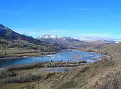
lower Flathead River
- Flathead River, NPS/USFS
- Missouri River, BLM
- East Rosebud Creek, Carbon County
Nebraska
- Missouri River, NPS
- Niobrara National Scenic River, NPS/USFWS
New Hampshire
- Lamprey River, NPS/Local Government
- Wildcat Brook, USFS
New Jersey
Lower Delaware River
- Delaware River (Lower), NPS/Local Government
- Delaware River (Middle), NPS
- Great Egg Harbor River, NPS/Local Government
- Maurice River, NPS/Local Government
- Musconetcong River
New Mexico
- Jemez River (East Fork), USFS
- Pecos River, USFS
- Rio Chama, BLM/USFS
- Rio Grande, BLM/USFS
- Red River BLM
New York
- Delaware River (Upper), NPS
North Carolina
- Chattooga River, USFS
- Horsepasture River, USFS
- Lumber River, North Carolina
- New River (Kanawha River), North Carolina
- Wilson Creek, USFS
Ohio
- Big Darby Creek and Little Darby Creek, Ohio
- Little Beaver Creek, Ohio
- Little Miami River, Ohio
Oregon

Salmon River in Oregon
- Big Marsh Creek, USFS
- Chetco River, USFS
- Clackamas River, USFS
- Collawash River, USFS
- Crescent Creek, USFS
- Crooked River, Oregon/BLM/USFS
- Deschutes River, BLM/USFS
- Donner und Blitzen River, BLM/USFS
- Eagle Creek, USFS
- Elk River, USFS
- Elkhorn Creek, BLM/USFS
- Fifteenmile Creek, USFS
- Fish Creek, USFS
- Grande Ronde River, BLM/USFS
- Hood River (East Fork), USFS
- Hood River (Middle Fork), USFS
- Illinois River, USFS
- Imnaha River, USFS
- John Day River, BLM/USFS
- Joseph Creek, USFS
- Kiger Creek, BLM
- Klamath River, BLM/Oregon
- Little Deschutes River, USFS
- Little Wildhorse Creek, BLM
- Lostine River, USFS
- Malheur River, USFS
- McKenzie River, USFS
- Metolius River, USFS
- Minam River, USFS
- North Fork Crooked River
- North Fork John Day River, USFS
- North Fork Malheur River, USFS
- North Fork Middle Fork Willamette River, USFS
- North Fork Owyhee River, BLM
- North Fork Smith River, USFS
- North Fork Sprague River, USFS
- North Powder River, USFS
- North Umpqua River, BLM/USFS
- Owyhee River, BLM
- Powder River, BLM
- Quartzville Creek, BLM
- Roaring River, USFS
- Rogue River, BLM/USFS
- Upper Rogue, USFS
- Salmon River, BLM/USFS
- Sandy River, BLM/USFS
- Snake River, USFS
- South Fork John Day River, BLM
- South Fork Roaring River, USFS
- Styx River (subterranean portion of Cave Creek), NPS
- Sycan River, USFS
- Wallowa River, BLM/Oregon
- Wenaha River, USFS
- West Little Owyhee River, BLM
- White River, BLM/USFS
- Whychus Creek (formerly Squaw Creek),[4] USFS
- Wildhorse Creek, BLM
- Zigzag River, USFS
Pennsylvania
- Allegheny River, USFS
- Clarion River, USFS
- Delaware River (Lower), NPS/Local Government
- Delaware River (Middle), NPS
- Delaware River (Upper), NPS
- White Clay Creek, NPS/Local Government
Puerto Rico
- Rio Mameyes, USFS
- Rio de la Mina, USFS
- Rio Icacos, USFS
South Carolina
- Chattooga River, USFS
South Dakota
- Missouri River, NPS
Tennessee
- Obed River, NPS
Texas
- Rio Grande, NPS
Utah
- Virgin River, NPS
Vermont
Washington
- Illabot Creek, USFS
- Klickitat River, USFS
- Pratt River. USFS
- Snoqualmie River (Middle Fork), USFS
- Skagit River, USFS
- White Salmon River, USFS
West Virginia
- Bluestone River, NPS
Wisconsin
- St. Croix River (Upper), NPS/Minnesota and Wisconsin
- St. Croix River(Lower), NPS/Minnesota and Wisconsin[5]
- Wolf River, Wisconsin
Wyoming

Shoshone Falls on the Snake River
- Clarks Fork of the Yellowstone River, USFS
- Snake River Headwaters, NPS
References
- "Bautista Creek, California". rivers.gov. National Wild and Scenic Rivers System. Retrieved October 27, 2014.
- "Owens Rivers Headwaters, California". rivers.gov. National Wild and Scenic Rivers System. Retrieved October 27, 2014.
- "Explore Designated Rivers". Rivers.gov. Retrieved 2016-08-01.
- U.S. Geological Survey Geographic Names Information System: Whychus Creek
- "Lower St Croix". Archived from the original on 2010-06-10. Retrieved 2009-05-04.
- Wild and Scenic Rivers by State, Interagency Wild and Scenic Rivers Coordinating Council
External links
This article is issued from Wikipedia. The text is licensed under Creative Commons - Attribution - Sharealike. Additional terms may apply for the media files.