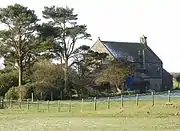
Largoward
Largoward is a village in East Fife, Scotland, lying on the road from Leven to St Andrews in the Riggin o Fife, 4½ miles north-east of Lower Largo and 6½ miles south-west of St Andrews.[1] It is an agricultural and former mining village, one of the three main villages of the civil parish of Kilconquhar, along with Colinsburgh and the village of Kilconquhar.[2] Coal must have been worked for a considerable length of time in the district, as it is recorded that coal was driven annually from Falfield, just north-west of the village, to Falkland Palace for the use of King James VI.[3]
| Largoward | |
|---|---|
 Largoward Location within Fife | |
| Population | 419 |
| OS grid reference | NO4694007589 |
| Council area | |
| Lieutenancy area | |
| Country | Scotland |
| Sovereign state | United Kingdom |
| Post town | Leven |
| Postcode district | KY9 |
| Police | Scotland |
| Fire | Scottish |
| Ambulance | Scottish |
| UK Parliament | |
| Scottish Parliament | |

Largoward and District Community Council covers the northern part of the civil parish of Kilconquhar, plus the Cassingray area to the east (Carnbee parish).[4][5]
The name probably means Largo's field,[6][7] Largo parish and Largo Law being just west of the village. The name Largoward is recorded from the 18th century. Ward or waird is a Scots word meaning an enclosed piece of land, chiefly for pasture. Although in the parish of Kilconquhar, it appears to have had a connection with the parish or barony of Largo as regards tenure.[8] The word ward appears in the neighbouring placenames of Balcarres Ward (Kilconquhar parish),[5] West Ward and Knights Ward (Carnbee parish).[8]
The population of the village and the adjacent settlements is 419 (2011 Census).[9]
Church
Until 1835 the church for Largoward was the parish church at Kilconquhar, about 5 miles away. Because of this distance, the present church building in Largoward was erected as a chapel of ease in 1835.[10] Following a petition presented in July 1857, under the New Parishes (Scotland) Act, 1844, Largoward was made a parish, for ecclesiastical purposes only, in 1860.[11]
References
- Ordnance Gazetteer of Scotland, by Francis Groome, 2nd edition 1896; article on Largoward
- Third Statistical Account of Scotland; volume on Fife, by Alexander Smith, Publ. 1952. Article on Kilconquhar
- The New Statistical Account of Scotland by the Ministers of the Respective Parishes, Vol. IX Fife-Kinross. Publ. William Blackwood & Sons, Edinburgh, 1845; article on Kilconquhar
- Map of Largoward and District Community Council, publ. by Fife Council publications.1fife.org.uk/uploadfiles/publications/CommunityCouncilMap_Largoward%20and%20District.pdf retrieved May 2016
- Ordnance Survey 1 inch to 1 mile Sheet 41 - North Berwick Publication date: 1899 available from National Library of Scotland maps.nls.uk as at May 2016
- According to Rev Dr Donald MacEwan, former minister of Largoward - see Web site of Largoward and St Monans Church of Scotland Parish Churches www.stmonanslargowardkirk.org retrieved May 2016
- "Fife Place-name Data :: Largoward". fife-placenames.glasgow.ac.uk.
- Glasgow University web site fife-placenames.glasgow.ac.uk/placename/?id=2052 retrieved May 2016
- Census of Scotland 2011, Table KS101SC – Usually Resident Population, publ. by National Records of Scotland. Web site http://www.scotlandscensus.gov.uk/ retrieved March 2016. See “Standard Outputs”, Table KS101SC, Area type: Output Area
- Web site of Largoward and St Monans Church of Scotland Parish Churches www.stmonanslargowardkirk.org retrieved May 2016
- Edinburgh Gazette, 10 July 1857, p.625