Kuakata
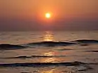
Kuakata (Bengali: কুয়াকাটা) is a town in southeastern Bangladesh known for its panoramic sea beach.[1][2] Kuakata beach is a sandy expanse 18 kilometres (11 mi) long and 3 kilometres (1.9 mi) wide.[3] From the beach one can have an unobstructed view of both sunrise and sunset over the Bay of Bengal.[1]
Kuakata
কুয়াকাটা | |
|---|---|
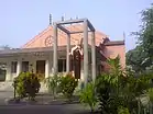
 .JPG.webp)     .JPG.webp) From top: Fishing, Sunset at Kuakata beach, Buddhist temples, Sea shore, Mangrove forest and Kuakata Grand Hotel & Sea Resort | |
| Nickname(s): Daughter of Sea (সাগরকন্যা) | |
| Coordinates: 21°49′16″N 90°07′11″E | |
| Country | Bangladesh |
| Division | Barisal Division |
| District | Patuakhali District |
| Upazila | Kalapara |
| Time zone | UTC+6 (BST) |
Etymology
The name Kuakata originated from the word 'kua' — the Bengali word for "well" which was dug on the seashore by the early Rakhine settlers(Burmese tribes) in quest of collecting drinking water.[4] They landed on the Kuakata coast in the 18th century after being expelled from Arakan (Myanmar) by the Burmese extremests .[5] Afterwards, it has become a tradition of digging wells in the neighbourhoods of Rakhaine tribes for water.
Geography
Kuakata is in Kalapara Upazila, Patuakhali District.[6] It is about 320 kilometres (200 mi) south of Dhaka, the capital, and about 70 kilometres (43 mi) from the district headquarters.[1]
Demographics
According to the 2011 Bangladesh census, Kuakata had 2,065 households and a population of 9,077.[7]
Culture


Kuakata is a place of pilgrimage for Hindu and Buddhist communities. Innumerable devotees arrive here at the festivals of 'Rush Purnima' and 'Maghi Purnima'. On these occasions the pilgrims take holy baths at the bay and participate in the traditional fairs.[1] One may visit a 100-year-old Buddhist temple where the statue of Goutama Buddha and two 200-year-old wells are located.
Notable residents
- Principle Md Habibullah
- Khatibul Ummah, Allama Hafizur Rahman Siddik
Beach
Kuakata offers a full view of the sunrise and sunset from the same white sandy beach in the water of the Bay of Bengal. Locally known as Shagor Kannya (Daughter of Ocean), the long strip of dark, marbled sand stretches for about 18 kilometres (11 mi). The long, wide beach at Kuakata has a typical natural setting. This sandy beach has gentle slopes into the Bay of Bengal. Kuakata is also a sanctuary for migratory winter birds.
On the eastern end of the beach is Gongamati Reserved Forest, an evergreen mangrove forest and snippet of the original Kuakata. (When the Rakhines settled in the area in 1784, Kuakata was part of the larger Sundarbans forest. However, the Sundarbans is one-hour away by speed boat.) As a mangrove forest, Gongamati, like the Sundarbans, offers some protection against tidal surges. However, it too is being threatened by logging and deforestation. The best way to reach the forest is by foot or bike along the beach, where flag-flying fishing boats can be seen trawling the coast. Visiting Gangamati in the late afternoon is a perfect time to watch the sun cast shadows on the exposed mangrove roots.
On 13 September 2007 the government had announced a red alert in Kuakata as caution for a possible tsunami.[8]
Gallery
 Kuakata Beach
.JPG.webp) Beach
Beach.JPG.webp) Mangrove forest
Mangrove forest.jpeg.webp) Kuakata at early morning
Kuakata at early morning
See also
- List of cities and towns in Bangladesh
- Cox's Bazar – a tourist beach town in southwestern Bangladesh
- Patenga – a tourist beach in southwestern Bangladesh
References
- "Tourist Attractions in Bangladesh". Bangladesh Parjatan Corporation. Archived from the original on 19 July 2011.
- "List of Bangladeshi Villages". Travel Tips. USA Today. Retrieved 4 April 2015.
- Kabir, Ekramul (2012). "Kalapara Upazila". In Islam, Sirajul; Jamal, Ahmed A. (eds.). Banglapedia: National Encyclopedia of Bangladesh (Second ed.). Asiatic Society of Bangladesh.
- Aouwal, Abdul (2016). "Kuakata National Park of Bangladesh". Ontaheen. Retrieved 26 June 2016.
- Majida, Mustapha (2005). The Rakhaines: Aborigines in Bangladesh. Dhaka: Mowla Brothers. ISBN 978-9844104662.
- "NGA GeoName Database". National Geospatial Intelligence Agency. Retrieved 9 January 2016.
- "Population Census 2011: Patuakhali Table C-01" (PDF). Bangladesh Bureau of Statistics. Archived from the original (PDF) on 13 November 2014. Retrieved 11 July 2014.
- "Coasts evacuated on tsunami alert". The Daily Star. 13 September 2007.
External links
| Wikimedia Commons has media related to Kuakata. |
- কুয়াকাটা সমুদ্র সৈকত [Kuakata beach]. Kalapara Upazila (in Bengali). Archived from the original on 8 June 2016.
- Kuakata Travel Guide
| Wikivoyage has a travel guide for Kuakata. |