Jeju Olle Trail
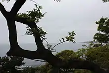
Jeju Olle Trail is a long-distance footpath on Jeju Island, an island off the south-west coast of South Korea.[1] The route mainly follows the coastline and consists of 21 connected numbered main routes, 5 sub-routes, and a short spur that connects to Jeju International Airport. On average, the routes are 16km in length and in total amount to 422km. The exact length and locations change over time as trails are modified or re-routed.[2]
| Jeju Olle Trail | |
|---|---|
 | |
| Length | 422 km (262 mi) |
| Location | Jeju Island, South Korea |
| Trailheads | Route 1: Shiung-ri Route 21: Jongdali |
| Use | Hiking |
| Hiking details | |
| Trail difficulty | Easy to Moderate |
| Season | All (heat advisory for July and August) |
| Months | All (particularly April, May, September, October) |
| Sights | UNESCO World Heritage Site Seongsan Ilchulbong, Sanbangsan Geopark |

History
Jeju Olle Trail was founded by ex-journalist Suh Myung-suk.[3] She walked Camino de Santiago in 2006, which is a UNESCO World Heritage site.[4] Inspired from this experience, Suh Myung-suk founded the Jeju Olle Foundation with the investigation of the Jeju-Si, to develop the tourist path like Santiago Pilgrimage route, in South Korea. Jeju Olle Foundation operates the program to develop the new routes for Jeju Olle Trail. This program includes selecting the right paths to walk, connecting them to create courses, expanding the path's width, and removing obstacles.[5]
Routes
Route 1
Siheung - Gwangchigi Olle
Distance: 15.1 km
Difficulty: Intermediate
Jeju Olle’s first route connects Oreums to the ocean. The route starts near Siheung Elementary School and connects to an evergreen field, Malmi Oreum(small extinct volcano) and Al Oreum(small extinct volcano) with a panoramic view of Seongsan Ilchulbong(peak) and U-do Island. [6]
Route 1-1
U-do(island) - Olle
Distance: 11.3 km
Difficulty: Intermediate
This sub-route requires a 15-minute ferry ride from Seongsan Port to the island of Udo. [7]
Route 2
Gwangchigi - Onpyeong Olle
Distance: 15.2 km
Difficulty: Intermediate
Starting at Gwangchigi Beach, the trail passes Siksan-bong(peak), Daesusan-bong(peak), Honinji(wedding pond) to a small beach in Onpyeong-ri. The attraction continues with path across the field along inland water and mountain path.[6]
Route 3
Onpyeong - Pyoseon Olle
Distance: 20.9 km
Difficulty: Advanced
This route connects Tong Oreum (small extinct volcano) to Dokja-bong(peak), where include camellia path, a mandarin path, and other kinds of walking paths, This route also continue until the Kim Young Gap Gallery Dumoak.[6]
Route 4
Pyoseon - Namwon Olle
Distance: 19.0 km
Difficulty: Intermediate
This Badang-Olle(seaside trail) begins in the vacant lot in front of the Haevichi Hotel, and continues through the trail up to Gamarigae.[7]
Route 5
Namwon - Soesokkak Olle
Distance: 13.4 km
Difficulty: Intermediate
The route goes on from Namwon to Keun-ung (hill) Walkway and Soesokkak Estuary where freshwater and seawater comes together.[7]
Route 6
Soesokkak - Jeju Olle Tourist Center Olle
Distance: 11.0 km
Difficulty: Basic
The route goes along coast and through downtown starting at Soesokkak-dari (bridge) and passing through Seogwipo City. Past Lee, Jung-seop Street, the route continues to Jeju Olle Tourist Center.[6]

Route 7
Jeju Olle Tourist Center - Wolpyeong Olle
Distance: 17.6 km
Difficulty: Intermediate
Route 7 is a coastal Olle starting at Jeju Olle Tourist Center, passing through Beophwan-pogu(port) and finishing at Wolpyeong. Near the start of this trail is the rock spire of Oedolgae and its surrounding cliffs.[6]
Route 8
Wolpyeong - Daepyeong Olle
Distance: 19.6 km
Difficulty: Intermediate
This Badang Olle(seaside walk) begins at the natural springs of Nonjitmul passing through the coastal roads. This route includes Joosang Jeolli where lava flowed to the ocean cooled down to form striking hexagonal columns of basalt and the Yerae Ecological Park full of seasonal flowers.[6]
Route 9
Daepyeong - Hwasun Olle
Distance: 6.7 km
Difficulty: Advanced
Route 10
Hwasun - Moseulpo Olle
Distance: 15.6 km
Difficulty: Intermediate
This coastal route begins at the Hwasun Golden Sand Beach and ends at Hamo-ri in Daejeong-eup. The route passes by Sseokeun-dari(bridge), Hwangwoochi Beach, Sanbang-san(mountain) and Songak-san.[7]
Route 11
Moseulpo - Mureung Olle
Distance: 17.3 km
Difficulty: Intermediate
Starting at Hamo Sports Park, route 11 connects Moseul-bong and Sinpyeong forest to Mureung Farm. On top of Moseul-bong(peak), visitors can see the Oreums and sea of Southwest Jeju.[6]
Route 12
Mureung - Yongsu Olle
Distance: 17.5 km
Difficulty: Intermediate
It is the first route to enter Jeju City, after connecting the entire Seogwipo City along the coast. From Mureung-2ri to Jeolbuam at Yonsu-pogu(port), the route continues through field, ocean, and an oreum. [7]
Sign Post
As Jeju Olle is a road where hikers walk freely along the road, Jeju Olle Foundation offers several signposts to help the tourist to provide the information of the route.
Ganse
Ganse is the name of Jeju’s pony. The word comes from Ganse-dari, meaning slow idler in Jeju. Ganse points toward the direction of the route at a forked road. At points of tourist attractions, Ganse located with the description of the site.[8]
Ribbon
Vibrant blue ribbons representing Jeju ocean and orange ribbons symbolizing Jeju tangerines are tied to trees and utility poles. Ribbons are hung at a height, above the eye level.[8]
Arrow
Blue arrow on the ground, stonewall and utility poles is the basic symbol that guides hikers along the Jeju Olle Trail. Orange arrows point in the reverse direction of the trail. This is the post that visitors should follow, when hiking from the finishing point to the starting point.[6]
Wheelchair Accessible Area Signpost
An S on Ganse’s saddle indicates the starting point of wheelchair accessible area and F for the finishing point. The wheelchair sticker is put on the blue arrows which indicate forward directions.[8]
Stamp Ganse
There are Ganse-shaped stamp stations with signature stamps of each route at the starting points, mid-points, and finishing points of each route. It is required to get three stamps of all routes on Jeju Olle Passport to receive a finisher’s certificate and a medal.[8]
International Awards
Jeju Olle Trail won the inaugural International Award at the 21st International Trails Symposium in 2013 for working diligently to develop trails since its founding in 2007.[9]
World Trails Conference
Jeju Olle Trail has hosted the International Trails Conference every year since its inception in 2010 and attracts trail experts from all over the world.[10]
See also
References
- "Jeju Olle Trail Essential Planning Guide for the walking trail around Jeju Island in South Korea".
- "올레길". terms.naver.com (in Korean). Retrieved 2020-11-06.
- Thacker, Todd (September 2010). "Healing powers of an island trek".
- "제주올레". www.jejuolle.org.
- "JejuOlleOfficial". www.jejuolle.org. Retrieved 2020-11-06.
- "Jeju Olle". www.jejuolle.org (in Korean). Retrieved 2020-11-06.
- "Jeju Olle Trail Part Two: Routes 2 to 7-1 Video & Guide". Going the Whole Hogg. 2019-10-29. Retrieved 2020-11-06.
- Whitten, Richard (2014-11-06). "Jeju Island on Foot - The Jeju Olle Trails". SeoulSync. Retrieved 2020-11-06.
- "American Trails Announces 2013 National Trails Awards Winners at the 21st International Trails Symposium".
- "World Trails Network". www.worldtrail.org.