Ják
Ják is a village in Vas County, on the western boundary of Hungary.
Ják | |
|---|---|
_7.jpg.webp) The parish church of Ják, consecrated by Amadeus Pok in 1256 | |
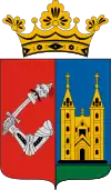
 Seal | |
| Coordinates: 47.13931°N 16.58244°E | |
| Country | |
| County | Vas |
| Area | |
| • Total | 44.95 km2 (17.36 sq mi) |
| Population (2004) | |
| • Total | 2,475 |
| • Density | 55.06/km2 (142.6/sq mi) |
| Time zone | UTC+1 (CET) |
| • Summer (DST) | UTC+2 (CEST) |
| Postal code | 9798 |
| Area code(s) | 94 |
Ják Church
The parish church of Ják is the most complete Romanesque Church in Hungary. It was originally built as the church of a Benedictine monastery. The village church at that time was a rotunda in front of the façade of the main doorway of Ják church.
Both outside and inside the church is adorned with rich sculptures. The 3 naves and 3 apses are formed in a basilica structure. Columnar capitals are sculptured by plant and some animal ornamentation.
The rotunda has been built with 4 apses and 2 floors.
Photo gallery

_9.jpg.webp)
_10.jpg.webp)
_3.jpg.webp) Saint George's Abbey, Ják
Saint George's Abbey, Ják

 Medieval relief of Saint Matthew in the Church of Ják (13th century).
Notable people
- Dezső Novák (1939 – 2014), Hungarian footballer
References
- Aradi N. (Ed.): A művészet története Magyarországon. (The History of Arts in Hungary). Gondolat, Budapest
- Fülep L. (Ed.): A magyarországi művészet története. (The History of the Hungarian Arts). Budapest
- Gerevich T.: Magyarország románkori emlékei. (Die romanische Denkmäler Ungarns.) Egyetemi nyomda. Budapest, 1938.
- Gerő L. : Magyar műemléki ABC. Budapest, 1984
- Gervers-Molnár, V. (1972): A középkori Magyarország rotundái. (Rotunda in the Medieval Hungary). Akadémiai, Budapest
- Henszlmann, I. (1876): Magyarország ó-keresztyén, román és átmeneti stylü mű-emlékeinek rövid ismertetése, (Old-Christian, Romanesque and Transitional Style Architecture in Hungary). Királyi Magyar Egyetemi Nyomda, Budapest
- Marosi E.: A román kor művészete, (Art of the Romanesque Ages). Corvina, Budapest, 1972, ISBN 963-13-2000-6
External links
| Wikimedia Commons has media related to Ják. |
- Street map (in Hungarian)
- Aerial photographs of Ják
This article is issued from Wikipedia. The text is licensed under Creative Commons - Attribution - Sharealike. Additional terms may apply for the media files.