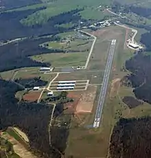
Huntsville Municipal Airport (Arkansas)
Huntsville Municipal Airport (FAA LID: H34) is a city-owned, public-use airport located two nautical miles (2.3 mi, 3.7 km) southwest of the central business district of Huntsville, a city in Madison County, Arkansas, United States.[1]
Huntsville Municipal Airport | |||||||||||||||
|---|---|---|---|---|---|---|---|---|---|---|---|---|---|---|---|
 | |||||||||||||||
| Summary | |||||||||||||||
| Airport type | Public | ||||||||||||||
| Owner | City of Huntsville | ||||||||||||||
| Serves | Huntsville, Arkansas | ||||||||||||||
| Elevation AMSL | 1,749 ft / 533 m | ||||||||||||||
| Coordinates | 36°04′42″N 093°45′17″W | ||||||||||||||
| Runways | |||||||||||||||
| |||||||||||||||
| Statistics (2010) | |||||||||||||||
| |||||||||||||||
Facilities and aircraft
Huntsville Municipal Airport covers an area of 70 acres (28 ha) at an elevation of 1,749 feet (533 m) above mean sea level. It has two runways: 12/30 is 3,600 by 60 feet (1,097 x 18 m) with an asphalt pavement and 3/21 is 1,250 by 60 feet (381 x 18 m) with a turf surface.[1]
For the 12-month period ending November 30, 2010, the airport had 5,000 aircraft operations, an average of 13 per day: 96% general aviation and 4% military. At that time there were 27 aircraft based at this airport: 85% single-engine, 4% multi-engine, and 11% ultralight.[1]
History
The Huntsville Airport land was purchased from Bryan and Kathleen Mitchusson in November of 1983, with construction starting shortly afterward. The land was purchased with grant money that the State of Arkansas reserves from aviation fuel sales tax and aviation-related sales tax.
The 3600′ runway is the highest airport elevation in Arkansas. The first tower was donated by the Springdale Municipal Airport, and later the main tower building was donated by Fayetteville’s Drake Field Airport. Several grants have been obtained over the years for paving the runway, purchasing fuel tanks, and building the hangars. The commission plans to apply for a grant soon to build an additional set of hangars.
The Airport Commission was established in March of 1983, with four of the original members still serving in the operation of the airport. Charles Coger, Mayor at the time of the airport’s creation, has served as Chairman of the Airport Commission since its establishment, with the exception of the first year. Tem Dotson has served as commissioner since its beginning, as well as Bill Smith, who held the position of Chairman during the first year. Tom Wyatt served as commissioner from 1983, resigning in 2007 to serve on the Huntsville City Council, and is still very active in meeting the airport’s operational needs. Wyatt’s wife, Ruth, has held a position as commissioner since her husband’s resignation.
References
- FAA Airport Form 5010 for H34 PDF. Federal Aviation Administration. effective 25 August 2011.
External links
- Aerial image as of 28 February 2001 from USGS The National Map
- FAA Terminal Procedures for H34, effective December 31, 2020
- Resources for this airport:
- FAA airport information for H34
- AirNav airport information for H34
- FlightAware airport information and live flight tracker
- SkyVector aeronautical chart for H34