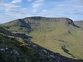
Hartaval
Hartaval (669 m) is a hill on the Isle of Skye. It is located on the Trotternish peninsula in the north of the isle, and is the second highest peak on Trotternish ridge after The Storr.
| Hartaval | |
|---|---|
 Hartaval | |
| Highest point | |
| Elevation | 669 m (2,195 ft) [1] |
| Prominence | 180 m (590 ft) |
| Parent peak | The Storr |
| Listing | Marilyn, Graham |
| Geography | |
| Location | Skye, Scotland |
| Parent range | Trotternish |
| OS grid | NG480551 |
| Topo map | OS Landranger 23 |
It has a fine, steep face on its eastern side that was formed by a series of landslides.[2]
References
- "Hartaval". hillbagging.co.uk. Retrieved 11 May 2020.
- "Hartaval – walkinghighlands". walkinghighlands. Retrieved 11 May 2020.
This article is issued from Wikipedia. The text is licensed under Creative Commons - Attribution - Sharealike. Additional terms may apply for the media files.