Gande (river)
The Gande is a river of Lower Saxony, Germany. It is a right-hand tributary of the River Leine.
| Gande | |
|---|---|
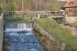
 The Gande in Bad Gandersheim | |
| Location | |
| Country | Germany |
| State | Lower Saxony |
| Physical characteristics | |
| Source | |
| • location | near Lamspringe |
| Mouth | |
• location | near Kreiensen |
• coordinates | 51°51′15″N 9°56′57″E |
| Length | 19.2 km (11.9 mi)[1] |
| Discharge | |
| • location | at Gandersheim gauge[2] |
| • average | 0.824 m3/s (29.1 cu ft/s) |
| • minimum | Record low: 0.010 m3/s (0.35 cu ft/s)/s (in 24.10.1977) Average low: 0.166 m3/s (5.9 cu ft/s) |
| • maximum | Average high: 15.9 m3/s (560 cu ft/s) Record high: 41.8 m3/s (1,480 cu ft/s) (in 28.10.1998) |
| Basin features | |
| Progression | Leine→ Aller→ Weser→ North Sea |
| Landmarks | Small towns: Bad Gandersheim |
| Tributaries | |
| • left | Meine, Eterna |
Course
The Gande rises near the town of Lamspringe on the eastern side of the Sackwald in the county of Hildesheim and flows from there southwards between the Sackwald and the Heber ridges. It enters the district of Northeim near Altgandersheim (a subdivision of Bad Gandersheim). At Bad Gandersheim it turns west and empties into the Leine at Kreiensen.
See also
References
- Environmental map service of Lower Saxony (Umweltkartendienst des Niedersächsischen Ministeriums für Umwelt, Energie und Klimaschutz)
- "Deutsches Gewässerkundliches Jahrbuch Weser-Ems 2008" (PDF) (in German). Niedersächsischer Landesbetrieb für Wasserwirtschaft, Küsten- und Naturschutz. Retrieved 2012-10-07.
This article is issued from Wikipedia. The text is licensed under Creative Commons - Attribution - Sharealike. Additional terms may apply for the media files.