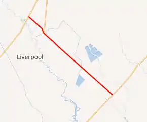
Farm to Market Road 2917
Farm to Market Road 2917 (FM 2917) is a farm to market road in Brazoria County, Texas.[1]
| ||||
|---|---|---|---|---|

| ||||
| Route information | ||||
| Length | 9.385 mi[1] (15.104 km) | |||
| Existed | 1964–present | |||
| Major junctions | ||||
| South end | ||||
| North end | ||||
| Location | ||||
| Counties | Brazoria | |||
| Highway system | ||||
| ||||
Route description
FM 2917 begins at FM 2004 between Hitchcock and Lake Jackson.[2] The route travels to the northwest, running parallel to and crossing branch lines of the Union Pacific Railroad to Monsanto and Solutia's Chocolate Bayou plants. Just north of a crossing of the busy Union Pacific main line, FM 2917 meets FM 2403 at a three-way stop.[3][4] Past the intersection continues to the northwest, through Liverpool and to its northern terminus at SH 35 (future SH 99) southwest of Alvin.[1]
History
FM 2917 was first designated on May 6, 1964, connecting SH 35 to FM 1561 (now FM 2004). Its routing has remained unchanged.[1]
Major intersections
The entire route is in Brazoria County.
| Location | mi[5] | km | Destinations | Notes | |
|---|---|---|---|---|---|
| | 0.0 | 0.0 | Southern terminus | ||
| | 7.5 | 12.1 | |||
| | 9.4 | 15.1 | Northern terminus | ||
| 1.000 mi = 1.609 km; 1.000 km = 0.621 mi | |||||
References
- Transportation Planning and Programming Division (n.d.). "Farm to Market Road No. 2917". Highway Designation Files. Texas Department of Transportation. Retrieved 2011-01-10.
- Transportation Planning and Programming Division (2012). Texas County Mapbook (PDF) (Map) (2012 ed.). 1:120,000. Texas Department of Transportation. p. 584. OCLC 867856197. Retrieved 2011-01-10.
- Transportation Planning and Programming Division (2012). Texas County Mapbook (PDF) (Map) (2012 ed.). 1:120,000. Texas Department of Transportation. p. 583. OCLC 867856197. Retrieved 2011-01-10.
- Transportation Planning and Programming Division (2012). Texas County Mapbook (PDF) (Map) (2012 ed.). 1:120,000. Texas Department of Transportation. p. 563. OCLC 867856197. Retrieved 2011-01-10.
- Google (2011-01-10). "Overview map of Farm to Market Road 2917 Distances Between Interchanges" (Map). Google Maps. Google. Retrieved 2011-01-10.
This article is issued from Wikipedia. The text is licensed under Creative Commons - Attribution - Sharealike. Additional terms may apply for the media files.
