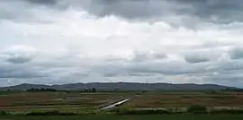
Eola Hills
The Eola Hills are a range of hills northwest of Salem, Oregon, United States.[2] They stretch from the community of Eola about 10 miles (16 km) north to Yamhill County.
| Eola Hills | |
|---|---|
 Eola Hills | |
| Highest point | |
| Elevation | 1,170 ft (360 m) [1] |
| Geography | |
| Country | United States |
| State | Oregon |
| District | Yamhill County |
| Range coordinates | 45°4′31.425″N 123°7′25.362″W |
| Topo map | USGS Mission Bottom |
They are divided from the Salem Hills by the Willamette River at Eola.
See also
- Eola-Amity Hills AVA
- Bethel Heights Vineyard, one of the first vineyards planted on the Eola Hills
References
- "Eola Hills". ListsOfJohn.com. Retrieved 2012-11-18.
- "Eola Hills". Geographic Names Information System. United States Geological Survey.
This article is issued from Wikipedia. The text is licensed under Creative Commons - Attribution - Sharealike. Additional terms may apply for the media files.
