Duder Regional Park
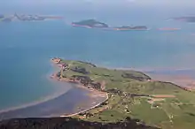
Duder Regional Park is a 162 ha (400 acres) regional park situated on the coast to the east of Auckland city, New Zealand.

History

The park was created in 1995 after the sale of the land by the Duder family to the Auckland Regional Council.[1][2] Prior to the sale the land had been farmed by descendants of Thomas Duder for about 130 years. The land was purchased in 1866 from the original Maori owners Ngai Tai.
Ngāi Tai association with the Whakakaiwhara Peninsula begins with the visit of the Tainui canoe in the 1300s. The Tainui moored in the shelter of the Peninsula from a storm while it was travelling up east coast of Aotearoa, having arrived from Hawaiiki. The crew went ashore and ate fruit from the forest on the Peninsula. This is the origin of the name Whakakaiwhara, which means to eat (kai) the edible bracts (whara) of the kiekie vine. The place where the canoe moored is known as ‘Te Tauranga ō Tainui’ or ‘The Anchorage of Tainui’.
While the Tainui canoe was moored there, a crew member called Tāne Whakatia planted a karaka berry on the point of the Peninsula. It grew into a tree known as ‘Huna ā Tāne’ or the ‘Tree of Tāne’. Though this tree no longer exists, its descendants today are the impressive karaka trees on the Peninsula.
Early occupation
After leaving the Whakakaiwhara Peninsula, the Tainui canoe travelled west to the Tamaki River. It was then carried across the portage from the Waitemata to the Manukau Harbour and eventually continued down to Kawhia. Several crew members left the canoe in the Tamaki area and settled there. Later, some of their descendants built kāinga (villages) and pā (fortifications) beside the Wairoa River and on the Whakakaiwhara Peninsula. These people became known as Ngāti Tai, taking their name from the ancestor Taihaua and the Tainui canoe. Ngāti Tai was part of a wider tribal grouping known as Ngāoho, which unified all the people of Tainui descent in the region.
An extra 13.7 ha was added in 2010 to prevent coast development obstructing views from the park.[3]

Description
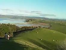
The park is a working farm bounded to the west by Duders Beach. It is situated on a headland and offers commanding views of the Hauraki Gulf. There is limited native bush as most of the land is grassed. There are no designated picnic areas and facilities are limited.
Small numbers of the endangered tuturiwhatu (New Zealand dotterel) breed on shell banks south of the park. This area is not accessible to the public.
References
- Duder - Auckland Regional Council Archived October 14, 2008, at the Wayback Machine
- Duder's Beach / Umupuia - Pohutukawa Coast Archived October 12, 2008, at the Wayback Machine
- "More land secured for Duder Regional Park". ARC. 30 April 2010. Archived from the original on 15 May 2010. Retrieved 1 May 2010.
External links
| Wikimedia Commons has media related to Duder Regional Park. |
- Auckland Regional Council Management plan - Gives descriptions of geology of Duder park, Waiheke and Hunua etc