Denton with Wootton
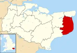
Denton with Wootton is a civil parish in the Dover District of Kent, England. The parish contains the settlements of Denton and Wootton, 1 mile (1.6 km) apart.
| Denton with Wootton | |
|---|---|
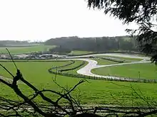
 A country lane at the north of the parish | |
 Denton with Wootton Location within Kent | |
| Civil parish |
|
| District | |
| Shire county | |
| Region | |
| Country | England |
| Sovereign state | United Kingdom |
| Post town | Canterbury |
| Postcode district | CT4 |
| Police | Kent |
| Fire | Kent |
| Ambulance | South East Coast |
Denton with Wootton is approximately 30 miles (48 km) east-southeast from the county town of Maidstone. The south of the parish is 6 miles (10 km) north-west from the channel port of Dover, and the north, 7 miles (11 km) south-east from Canterbury. The A260 Barham to Folkestone road runs through the parish, and a 1 mile (1.6 km) section of the major A2 London to Dover road is part of the parish at the east.
Parishes surrounding Denton with Wootton are Barham at the north; Shepherdswell with Coldred at the north-east; Lydden at the south-east; Swingfield at the south; Acrise at the south-west; and Elham at the west.

The Lydden Hill Race Circuit is within the eastern border of Denton with Wootton.
There are two parish churches: St Martin's in Wootton, and St Mary Magdalene's in Denton.
Historically Denton and Wootton contained two manors each: Denton and Tappington at Denton; Wootton and Wickham Bushes at Wootton.[1][2]
References
- Hasted, Edward. "Parishes: Denton." The History and Topographical Survey of the County of Kent: Volume 9. Canterbury: W Bristow, 1800. 358-364. British History Online. Retrieved 29 March 2018
- Hasted, Edward. "Parishes: Wootton." The History and Topographical Survey of the County of Kent: Volume 9. Canterbury: W Bristow, 1800. 364-373. British History Online. Retrieved 29 March 2018
External links
 Media related to Denton with Wootton at Wikimedia Commons
