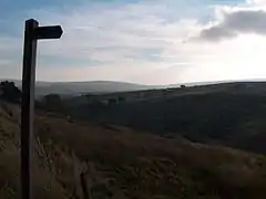
Cowshill
Cowshill is a village in County Durham, England.[1][2] It is situated at the top of Weardale, between Lanehead and Wearhead. In the 2001 census Cowshill had a population of 156.[3]
| Cowshill | |
|---|---|
 Weardale, Cowshill | |
 Cowshill Location within County Durham | |
| Population | 156 (2001 census) |
| OS grid reference | NY855405 |
| Civil parish | |
| Unitary authority | |
| Ceremonial county | |
| Region | |
| Country | England |
| Sovereign state | United Kingdom |
| Post town | BISHOP AUCKLAND |
| Postcode district | DL13 |
| Dialling code | 01388 |
| Police | Durham |
| Fire | County Durham and Darlington |
| Ambulance | North East |
| UK Parliament | |
The Church of St Thomas (1912) is located in Cowshill, and is the parish church for Heatherycleugh parish.[4] Bridge End Cottage is notable for being a 17th-century Bastle house, and is a Grade II listed building.[5] The Cowshill War Memorial commemorates the seven men from the area lost in the First World War and three who died in the Second World War.[6]
Burtree Ford was once considered a separate village, now considered as part of Cowshill, but its name is still apparent in Burtree Farm, and Burtreeford Bridge, over Killhope Burn, and the former Burtreeford Mill.
References
- Ordnance Survey: Landranger map sheet 87 Hexham & Haltwhistle (Map). Ordnance Survey. 2009. ISBN 9780319231678.
- "Ordnance Survey: 1:50,000 Scale Gazetteer" (csv (download)). www.ordnancesurvey.co.uk. Ordnance Survey. 1 January 2016. Retrieved 18 February 2016.
- "Wear Valley Settlement Summary Sheets" (PDF). Durham County Council. Archived from the original (PDF) on 7 October 2007. Retrieved 14 October 2016.
- "Cowshill, County Durham | Co-Curate". co-curate.ncl.ac.uk. Retrieved 10 July 2017.
- Historic England. "BRIDGE END, Stanhope (1229602)". National Heritage List for England. Retrieved 10 July 2017.
- Project, North East War Memorials. "North East War Memorials Project -". www.newmp.org.uk. Retrieved 10 July 2017.