Chara (river)
The Chara (Russian: Ча́ра) is a left tributary of the Olyokma in Eastern Siberia, Russia. It is 851 kilometres (529 mi) long, and has a drainage basin of 87,600 square kilometres (33,800 sq mi).[1]
| Chara Yakut: Чаара | |
|---|---|
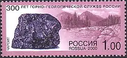
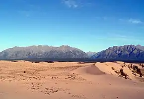
 View of the river and piece of charoite | |
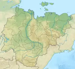
 Location in the Sakha Republic, Russia | |
| Location | |
| Country | Yakutia, Russia |
| Physical characteristics | |
| Source | |
| • location | Bolshoye Leprindo Lake |
| • coordinates | 56°38′40″N 117°35′4″E |
| • elevation | 975 m (3,199 ft) |
| Mouth | Olyokma |
• coordinates | 60°19′10″N 120°52′28″E |
• elevation | 126 m (413 ft) |
| Length | 851 km (529 mi) |
| Basin size | 87,600 km2 (33,800 sq mi) |
| Discharge | |
| • average | 638.83 m3/s (22,560 cu ft/s) |
| Basin features | |
| Progression | Olyokma→ Lena→ Laptev Sea |

History
The region is famous for a peculiar mountain where charoite has been mined for decades. This intensely purple mineral, named after the river, is only found here and was discovered in the 1940s when a rail tunnel was constructed. Part of the Russian governmental debt was paid in charoite and slabs of this now expensive ornamental material were stored in basements of houses of the Hungarian capital city, Budapest.
Course
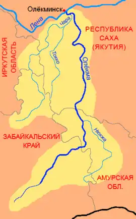
The Chara begins as an outflow of Bolshoye Leprindo lake in the Kodar Mountains, in northern Zabaykalsky Krai. It flows through the Chara Basin between the Kodar and Kalar Mountains, passing the Chara Sands, a 37 square kilometres (14 sq mi) area of active sand dunes. It joins the left bank of the Olyokma not far form its mouth in the Lena. The Chara has 103 tributaries over 10 km (6.2 mi) in length. The most important are the Apsat and the Zhuya from the left and the Tokko from the right.[2]
 Basin of the Olyokma |
References
- Река Чара in the State Water Register of Russia (Russian)
- Чара (река), Great Soviet Encyclopedia