Château-Gontier
Château-Gontier (French pronunciation: [ʃɑto ɡɔ̃tje]) is a former commune in the Mayenne department in north-western France. On 1 January 2019, it was merged into the new commune Château-Gontier-sur-Mayenne.[2]
Château-Gontier | |
|---|---|
Part of Château-Gontier-sur-Mayenne | |
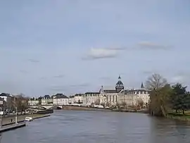
 Château-Gontier seen from the Europe Bridge | |
 Coat of arms | |
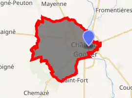
Location of Château-Gontier 
| |
 Château-Gontier  Château-Gontier | |
| Coordinates: 47°49′43″N 0°42′10″W | |
| Country | France |
| Region | Pays de la Loire |
| Department | Mayenne |
| Arrondissement | Château-Gontier |
| Canton | Château-Gontier |
| Commune | Château-Gontier-sur-Mayenne |
| Area 1 | 27.88 km2 (10.76 sq mi) |
| Population (2017)[1] | 11,687 |
| • Density | 420/km2 (1,100/sq mi) |
| Time zone | UTC+01:00 (CET) |
| • Summer (DST) | UTC+02:00 (CEST) |
| Postal code | 53200 |
| Elevation | 26–99 m (85–325 ft) (avg. 83 m or 272 ft) |
| 1 French Land Register data, which excludes lakes, ponds, glaciers > 1 km2 (0.386 sq mi or 247 acres) and river estuaries. | |
Geography
It is about 30 km (19 mi) south of Laval,[3] the préfecture of the department of Mayenne. Château-Gontier is home to the Refuge de l'Arche, a refuge for abandoned or mistreated animals.
History
There are chalybeate springs close to the town. Château-Gontier owes its origin and its name to a castle erected in the first half of the 11th century by Gunther, the steward of Fulk Nerra of Anjou, on the site of a farm belonging to the monks of St Aubin d’Angers. On the extinction of the family, the lordship was assigned by Louis XI of France to Philippe de Comines. The town suffered severely during the wars of the League. In 1793 it was occupied by the Vendeans.[3]
Population and society
People
- Conan II, Duke of Brittany was found dead here during the Breton Norman Wars, likely the victim of poisoning.
- Claude Pompidou was born here.
- General Emile-René Lemonnier was born and buried here.
- Louis-François Allard (1735-1819), physician and politician.
- Guy de Charnacé (1825–1909), agronomist, writer, musicologist was born here.
- Alexis Roger, French composer (1814–1846), was born here.
- Olivier Peslier, French horse racing jockey was born here.
See also
References
- Téléchargement du fichier d'ensemble des populations légales en 2017, INSEE
- Arrêté préfectoral 14 November 2018 (in French)
- Chisholm, Hugh, ed. (1911). . Encyclopædia Britannica. 5 (11th ed.). Cambridge University Press. p. 963.
| Wikimedia Commons has media related to Château-Gontier. |