Cerro de la Calavera
Cerro de la Calavera (also known as Mount Calavera) is a 513 ft (156 m)[1] plug dome that last erupted 22 million years ago during the subduction of the Farallon Plate.[2] It is located within the city of Carlsbad, California in the United States. Cerro de la Calavera is only one of three volcanic plugs in Southern California and can easily be seen from either northbound Interstate 5 at Cannon Road or westbound on Lake Boulevard. Cerro de la Calavera is located within the Lake Calavera Preserve offering county maintained trails that lead directly into the ancient volcano, making for great hiking adventures.[2]
| Cerro de la Calavera | |
|---|---|
| Mount Calavera | |
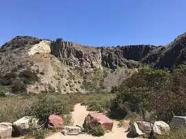 Cerro de la Calavera from the southwest | |
| Highest point | |
| Elevation | 513 ft (156 m) [1] |
| Prominence | 173 ft (53 m) [1] |
| Isolation | 0.94 mi (1.51 km) [1] |
| Coordinates | 33°10′03″N 117°16′54″W |
| Geography | |
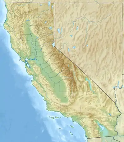 Cerro de la Calavera Location in California  Cerro de la Calavera Cerro de la Calavera (the United States) | |
| Location | Carlsbad, California, United States |
| Geology | |
| Last eruption | 22 million years ago, during the subduction of the Farallon Plate[2] |
| Climbing | |
| Easiest route | hiking |
References
- "Cerro de la Calavera, California". Peakbagger.com. Retrieved 2020-10-31.
- https://sites.google.com/site/michaellevensongeology/travelogue/mount-calavera-22-million-year-old-volcanic-plug
This article is issued from Wikipedia. The text is licensed under Creative Commons - Attribution - Sharealike. Additional terms may apply for the media files.