Cedar Creek (Indiana)
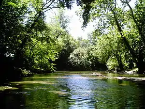
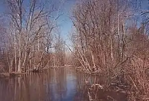
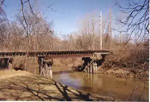
Called Mes-kwah-wa-se-pe or "old redwood creek" by Native Americans, Cedar Creek is the largest tributary of the St. Joseph River, draining 174,780 acres (707.3 km2) in the Eastern Corn Belt Plains of northeastern Indiana. It is 31.9 miles (51.3 km) long,[1] rising in northwestern DeKalb County and joining the St. Joseph just below the Cedarville Dam in Allen County.


Origins and history
Upper Cedar Creek originated as an ice-marginal channel at the western edge of the Erie Lobe of the Wisconsin Glacier and formed a single stream with the southwest-flowing Eel River which connected to the Wabash River. Lower Cedar Creek was a tributary of the ancestral Eel, carrying glacial meltwater under the ice through a tunnel valley known today as Cedar Creek Canyon.[2] Blockage of the Eel's channel by outwash from the canyon and a decline in the volume of meltwater caused lower Cedar Creek to reverse its flow. In so doing, it captured the flow of the upper Eel, a classic example of stream piracy that shifted Cedar Creek's drainage (about 175,000 acres) from the Eel-Wabash system to that of the St. Joseph-Maumee.[3]
Once a meandering stream, upper Cedar Creek was channelized (straightened and deepened) in the early 20th century for agricultural and urban drainage, which has increased the watershed's vulnerability to erosion and contaminated runoff. Once home to 27 species of freshwater mussel, Cedar Creek has experienced a drastic decline in mussel population since the 1980s.[4]
Course
Cedar Creek originates at Indian Lake (41º27'51" N 85º10'11" W), northwest of Corunna, Indiana, and comes into formal existence downstream at Cedar Lake.[5] Its DeKalb County section flows east-southeast from Indian Lake, loops around Waterloo, passes through Auburn, then angles southwest until it enters Allen County, where it is crossed by Indiana State Road 327 south of Garrett before turning back to the southeast toward Leo-Cedarville.
Lower Cedar Creek, from river mile 13.7 to its confluence with the St. Joseph, is officially designated as an "Outstanding State Resource Water" [6] and is one of four streams in Indiana's Natural, Scenic and Recreational Rivers system.[7]
Tributaries
See also
References
- U.S. Geological Survey. National Hydrography Dataset high-resolution flowline data. The National Map Archived 2012-04-05 at WebCite, accessed May 19, 2011
- Water Resource Availability in the Maumee River Basin, Indiana, Water Resource Assessment 96-5, Indianapolis:Indiana Department of Natural Resources, Division of Water, 1996, pp. 46-47.
- Sunderman, Jack A., "The Three Faces of Cedar Creek," ACRES Quarterly, v. 39, no. 4 (Fall 2000), pp. 6-7.
- United States Geological Survey, What Makes a Healthy Environment for Native Freshwater Mussels? Fact Sheet 124-00 (October 2000). Archived 2006-11-25 at the Wayback Machine
- Cedar Creek Wildlife Project
- 327 Indiana Administrative Code 2-1.5-19
- 312 Indiana Administrative Code 7-2-3
- U.S. Geological Survey Geographic Names Information System: Willow Creek
- U.S. Geological Survey Geographic Names Information System: Kell Ditch
- U.S. Geological Survey Geographic Names Information System: Willow Creek Ditch
- U.S. Geological Survey Geographic Names Information System: Willow Creek Branch
- U.S. Geological Survey Geographic Names Information System: Hatch Ditch
- U.S. Geological Survey Geographic Names Information System: Krumlauf Branch
- U.S. Geological Survey Geographic Names Information System: Yant Ditch
- U.S. Geological Survey Geographic Names Information System: White Lake
- U.S. Geological Survey Geographic Names Information System: Wappes Ditch
- U.S. Geological Survey Geographic Names Information System: Clark Chapman Ditch
- U.S. Geological Survey Geographic Names Information System: Fulk Lake
- U.S. Geological Survey Geographic Names Information System: Little Cedar Creek
- U.S. Geological Survey Geographic Names Information System: Black Creek
- U.S. Geological Survey Geographic Names Information System: Bilger Ditch
- U.S. Geological Survey Geographic Names Information System: Whan Ditch
- U.S. Geological Survey Geographic Names Information System: Roudy Lake
- U.S. Geological Survey Geographic Names Information System: Mud Lake
- U.S. Geological Survey Geographic Names Information System: Hinkley Ditch
- U.S. Geological Survey Geographic Names Information System: King Lake
- U.S. Geological Survey Geographic Names Information System: Yarde Ditch
- U.S. Geological Survey Geographic Names Information System: Sycamore Creek
- U.S. Geological Survey Geographic Names Information System: Schmadel Ditch
- U.S. Geological Survey Geographic Names Information System: Dosch Ditch
- U.S. Geological Survey Geographic Names Information System: Garrett City Ditch
- U.S. Geological Survey Geographic Names Information System: Diehl Ditch
- U.S. Geological Survey Geographic Names Information System: Peckhart Ditch
- U.S. Geological Survey Geographic Names Information System: Ober Ditch
- U.S. Geological Survey Geographic Names Information System: W Smith Ditch
- U.S. Geological Survey Geographic Names Information System: Matson Ditch
- U.S. Geological Survey Geographic Names Information System: Swartz Ditch
- U.S. Geological Survey Geographic Names Information System: Dibbling Ditch
- U.S. Geological Survey Geographic Names Information System: Cedar Lake
- U.S. Geological Survey Geographic Names Information System: Leins Ditch
- U.S. Geological Survey Geographic Names Information System: McCullough Ditch
- U.S. Geological Survey Geographic Names Information System: Indian Lake
External links
- U.S. Geological Survey Geographic Names Information System: Cedar Creek (Indiana)
- Topographic map from TopoQuest: Cedar Creek headwaters at Indian Lake
- Topographic map from TopoQuest: Cedar Creek headwaters at Cedar Lake
- Topographic map from TopoQuest: Cedar Creek confluence with St. Joseph River
- National Weather Service: Current Hydrologic Data for Cedar Creek at Auburn
- National Weather Service: Current Hydrologic Data for Cedar Creek near Leo-Cedarville
- Cedar Creek Wildlife Project
- St. Joseph River Watershed Initiative
- Maumee River Basin Commission
- Abstract: M. Larose et al., "Hydrologic and Atrazine Simulation of the Cedar Creek Watershed Using the SWAT Model," Journal of Environmental Quality, 36:521-531 (2007).