Bafing River
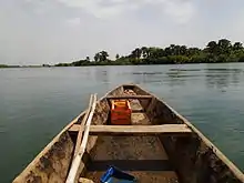
The Bafing River (Manding for "black river")[1] is the upper course and largest tributary of the Senegal River which runs through Guinea and Mali and is about 350 miles (560 km) long.


_p317_Die_h%C3%A4ngende_Br%C3%BCcke_%C3%BCber_den_Bafing.jpg.webp)
Course
The Fonta Djallon in Guinea is the source of the Bafing River,[2] 30 miles (48 km) north of Mamou.[1] It flows for about 350 miles (560 km)[3] and converges with the Bakoy River to join the Senegal River in western Africa.[4][5] The Bafing River is the largest tributary of the Senegal River, and contributes almost half of its total water volume.[6] The Bafing forms part of the international border between Guinea and Mali.[7]
Irrigation
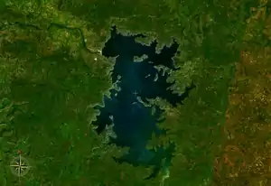
Flooding from the Bafing River along the Senegal River had been traditionally relied on as a means of supporting local agriculture. However, a drought in the 1970s necessitated the construction of dams on both the Bafing River and the Senegal River. The Manantali hydroelectric dam, completed in 1987,[8] is located on the Bafing River 90 kilometres (56 mi) upstream of Bafoulabé. It forms the largest artificial lake in Mali, Lake Manantali. The dam retains 11.3 cubic kilometres (2.7 cu mi) of water which is used to power the turbines during the dry season. As a result, the intensity of the maximum flood downstream of the dam has been reduced but during the dry season, a flow of between 150 m3/s (200 cubic yards per second) and 200 m3/s (260 cubic yards per second) is maintained.[9]
Ecology
There may be a significant chimpanzee population in the area east of the Bafing River.[10] The blue-headed bee-eater (merops muelleri) has also been sighted at the forest on the river south of the Manding Mountains.[11]
References
- Mohamed Saliou Camara; Thomas O'Toole; Janice E. Baker (7 November 2013). Historical Dictionary of Guinea. Scarecrow Press. p. 38. ISBN 978-0-8108-7969-0.
- M. van der Knaap; Food and Agriculture Organization of the United Nations (1994). Status of Fish Stocks and Fisheries of Thirteen Medium-sized African Reservoirs. Food & Agriculture Org. p. 19. ISBN 978-92-5-103581-8.
- Rand McNally and Company (1980). Rand McNally Encyclopedia of World Rivers. Rand McNally. p. 9.
- Caractéristiques physiques du fleuve Sénégal (in French), Organisation pour la mise en valeur du fleuve Sénégal, archived from the original on 16 July 2013, retrieved 2 June 2012.
- Maïga, Mahamadou (1995), Le bassin du fleuve Sénégal: de la Traite négrière au développement sous-régional autocentré (in French), L'Harmattan, p. 14 footnotes 4, 5.
- Development Anthropology Network: Bulletin of the Institute for Development Anthropology. The Institute for Development Anthropology. 1982. p. 10.
- Brownlie, Ian (1979). African Boundaries: A Legal and Diplomatic Encyclopedia. Institute for International Affairs, Hurst and Co. pp. 310–13.
- Itzchak Kornfeld (31 January 2020). Mega-Dams and Indigenous Human Rights. Edward Elgar Publishing. p. 109. ISBN 978-1-78643-549-1.
- Étude des impacts environnementaux du projet d’aménagement de Félou (PDF) (in French), Organisation pour la mise en valeur du fleuve Sénégal (O.M.V.S.), 2006, p. 63.
- Rebecca Kormos (2003). West African Chimpanzees: Status Survey and Conservation Action Plan (PDF). IUCN. p. 48.
- C. Hilary Fry (30 September 2010). The Bee-Eaters. Bloomsbury Publishing. p. 47. ISBN 978-1-4081-3687-4.